
On the first weekend of August, my dad and I joined a Sierra Club trip from Onion Valley to climb University Peak.
Summary
University Peak PCS Trip Saturday 1 August 2009
Route: Onion Valley trailhead via Kearsarge Pass trail and North Face (class 3), ~ 8 miles, 4500 ft.
Participants: 7
Friday 30 July
We left Cuptertino Friday afternoon a bit before 3PM. Taking 85 to 237 around the south end of the bay, our hopes of avoiding the traffic were quickly dashed by the time we’d reached 680. There were plenty of patches of stop and go, and even 84 east toward Livermore was pretty sluggish at the start. Still, by 5PM we’d cleared the Altamont Pass on 580, and things looked pretty promising. About the only excitement crossing the central valley was running the gas tank perilously close to empty before refueling in Oakdale. Traffic was actually pretty light, but inevitably we caught up with a convoy of cars behind slow moving SUV about 30 miles outside of Yosemite, and were stuck behind it until just before the entrance itself.
There were no stops in Yosemite until we reached the other side, around 8:00PM, a bit before sunset. Then it was a swift descent to Lee Vining, followed by nearly 2 hours on 395, as we headed south towards Independence. Indeed, we managed to miss the turnoff to Onion Valley when we did reach Independence at 10PM, and had to double back. The Owens Valley was warm but quiet as we followed that road, first straight, then winding up switchbacks, before suddenly dropping out from the sheer granite mountainside into a neat little valley, complete with a murmuring stream and occasional stands of Cottonwood Trees.
It was well past 11PM when we parked at the campground, and the logistics of finding an open campsite in the dark were surprisingly difficult. Still, there were a number of reserved sites that lacked occupants, and gambling that we were likely the latest arrival of the night, we took one of these, laid out sleeping bags, and called it a night. Even though it cooled off quite a bit through the early morning, I didn’t sleep particularly well.
Saturday 1 August
One of the many perks of camping on the east side of the Sierras is the gorgeous sunrise over the Owens Valley. Nonetheless I was not quite overjoyed when the sky began to become light around 5:30AM. After trying and failing to return to sleep for a while, I finally gave up, and wandered off to the parking lot to take some photos and see about breakfast. It took a good while to locate all the necessary ingredients (oatmeal, water, pot, stove, matches) but by 7AM Sassan had also gotten up, and we ate. Preparing the daypacks was a more complicated process than usual, as the clasp on Sassan’s hip belt was mangled beyond use (slammed in the car door?). Accordingly, everything had to be shifted into my pack or his waistpack.
We met hike leaders Kelly and Linda and the other members at the trailhead, Hank, Miguel and Rob, around 8:30AM. The plan was to follow the Kearsarge Pass trail up a few miles before crossing to the south side of the valley to follow a class 3 route up University Peak. Mindful of previous trip reports (another group had taken 13 hours) we expected to go slowly, but steadily. It was certainly a warm enough day, and it wasn’t far past the trailhead before we encountered backpackers delayering. Indeed, there were plenty of backpackers on the initial stretch, as we climbed mostly in wide switchbacks from 9,200 ft. toward Gilbert Lake (invisible) along the northern side of the creek. The view of the Owens Valley became steadily grander.
We passed Little Pothole Lake almost without seeing it, but when we crossed over a small ledge and dropped down to Gilbert Lake around 9:30AM, a break seemed appropriate. Gilbert Lake looked pretty idyllic too, although University Peak towered above it in a slightly intimidating fashion. We took pictures, had a snack, exchanged a few words with passing hikers, and then continued up the trail. Shortly before Flower Lake, we saw a use trail and a sign for Matlock Lake and we abandoned the main trail for good.
The use trail didn’t really last, and we climbed steeply SW through a forest of straggly pines to reach a little ridge (10700 ft.) overlooking Matlock and several other lakes. We dropped down a bit to cross the stream just below Bench Lake, then continued to ascend on the south side of the lake, following a series of large granite ledge up in the general direction of University Pass. Along the way, I found an abandoned T-Shirt on a rock, and Kelly keyed in the location on his GPS, so we could retrieve it on the return, if nobody had picked it up by then. Twenty minutes of this and we dropped down again, this time to a charming little lake (no name) around 11400 ft. Surrounded by moraine and scree, with University Peak not so much near us as towering over us, we had a pleasant rest.
The hard part began beyond the lake. We passed below the small snow field, and into serious scree. Angling our way up, progress was slow, and the rocks, which came in varying sizes, were for the most part loose. It was a case of one step forward and two back as we trudged laboriously onward seemingly straight toward the peak. The elevation affected several of us too. Still, it did level out a bit at the 12000 ft. mark, and we took a good many breaks as we went. Around 12500 ft. things got pretty steep again, and we opted for the even steeper, but more-or-less solid northern spine of the ridge, which presented a couple of class 3 moves. This got us almost, but not quite to what appeared to be the summit before becoming unpleasant. So we traversed west a couple of hundred yards, finding a steep section of scree with a snow field near the top. Kelly and Linda gave us a choice of routes (above the snowfield, or straight up it) and after scurrying up a short gully, and an even shorter section of class 3 rock, we were on the summit.
Superlatives seem natural when one is enjoying panoramic views atop a 13600 ft. peak, but the truth of the matter was that we were tired, and later than we’d intended, so everybody snapped a few photos, took a look at the summit register (rather soggy and smeared) and tried to eat. As Rob pointed out, when you’re tired and suffering the effects of altitude eating can require some effort. Still, the views were marvelous, stretching as they did across the Owens Valley on one side, and down Kings Canyon toward Cedar Grove on the other. It was perhaps less prominent a peak than Mt. Brewer (which we’d done the previous August) but it was certainly prominent enough, surrounded as it seemed by knife’s-edge ridges and barren basins.
It’s a dirty little secret that the return trip on many hikes is a drag. You’re tired and often in a bit of a hurry, the scenery is old news, and the main achievement of the trip is already done. Still, getting there is only half the battle, and so around 3PM we took our group photo, said farewell to the summit, and set about the serious task of getting down in one piece. The snowfield was harder to negotiate going down, and in general, the scree was less forgiving. Everybody slipped at least once, and there were constant showers of dislodged pebbles and occasional rocks. I had a nervous moment when, stepping rather hard on a crack, I managed to wedge my boot between two rocks. Unable to pull it out or move the rocks, I struggled vainly for several minutes, before, after unlacing my boot completely, I managed with great effort to slip the foot from the boot. Fortunately, the boot came out easily after that. Twenty minutes later, I accidentally dislodged a large boulder which fortunately missed (though more narrowly than I would have liked) the folks climbing below me.
The descent to the little lake at 11.4k ft. seemed interminable to me, but after countless near-slips and minor bangs on rocks, we reached the lake around 5PM. The view was still gorgeous. The ledges after the lake were a comparative dream to climb down – solid rock and no loose boulders to worry about. We recovered the T-shirt I’d seen on the way up, and had a great view of the valley and lakes (including Matlock Lake) lit by the late-afternoon sun. Rob however had gone on ahead, and his attempt to find a better descent route left him substantially below us on the wrong side of a stream and cliff. We shouted back and forth for a while, and slowly continued going down. Happily, he managed to find a reasonably direct route back after ascending a bit, and we continued from near Bench Lake. It was 6:30PM or so when we reached the main Kearsarge Pass trail. From there, in spite of the mosquitoes, Sassan and I took a goodly number of photos, while everybody else hurried back toward the trailhead. The afternoon light on the peaks and valley was magical, as were the clouds building around University Peak, but once the light had faded, there was nothing for it but to complete the final few miles down to camp.
In camp, we found everybody else busy preparing dinner. Sassan had crackers and cheese and avocado and I had a freeze-dried pasta meal. Perhaps my tastes have changed because I was distinctly unimpressed, though of course the warm meal was welcome. We chatted a bit over dinner, and the consensus was to dispense with hiking Kearsarge Peak and just head home the following morning. I think everybody was more than a little tired (11 hours hiking, particularly with a lot of scree, can do that to you). In spite of the day’s efforts, I did not sleep especially well that night either.
Sunday 2 August
I woke up early Sunday morning too, but managed to doze off again once or twice. I got up around 7AM, took a few photos, and after a bit of preparation, joined the others for breakfast. It was a leisurely meal, though by 8:30AM, everybody was decamped and saying their goodbyes. We decided to take the long way home, driving through what would hopefully be an interesting (and for us unexplored) part of eastern California.
It was plenty warm and sunny when we left around 9AM. By the time we’d descended down to Independence, it was downright hot. From Independence, we drove north along 395 to Big Pine. Here, we turned off onto Highway 168, heading toward the White Mountains and the Westguard Pass.
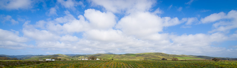
The White Mountains are of course a whole different ball of wax compared to the Sierras. Farther east, they are far dryer and thus have much less vegetation. The lower elevations we drove through were mostly rock with occasional shrubs. Above 6000 ft. we began to see trees, but only thin pine forests. The whole area appeared pretty forlorn, and in the first 12 miles, we passed only a handful of other cars. The Westguard Pass was a slight disappointment, for while on the west side there is a substantial climb, the east was basically a long wide basin, full of scattered trees and reddish earth.
A few miles further and we were passing through a wide and almost entirely desolate basin. You could see the road for at least 5 miles ahead, as well as an intriguing patch of green on the right, which turned out to be Deep Springs College. We turned off for a closer look, but were deterred at the gate by ‘No Trespassing’ signs. From the outside though, it looked like a modern ranch – animals, buildings, sprinklers, well-placed trees – in a somewhat odd location (nearest real town: 30 miles?).
We stopped for photos at the other end of the valley, just before the road passed over the Gilbert Summit. Looking back, we could not only Deep Springs and the rest of the White Mountain range, but also the snow-capped peaks of the Sierras which still loomed over the former (at a distance of 40 miles). Continuing east, we had long views of the Fish Lake Valley – again mostly empty earth and dust, but with a few seemingly oddly-placed green areas of what were no doubt agricultural productions. The temperature was in the mid-90s by the time we reached the junction with CA 264, and crossed the Nevada state line shortly thereafter around noon.
Fish Lake Valley was a long, spread out valley. We had ample views of the White Mountains from the east, including the peak itself, as well as the occasional hay and alfalfa farm, amidst what was otherwise just vacant land with the occasional sage brush. Even the ‘town’ of Fish Lake Valley was spread out, with the market and cemetery being nearly 10 miles apart. With such surroundings, distances were hard to judge – you might easily see a car approaching from 3 or 4 miles away. We followed NV 266 north for most of the length of the mountain range, turning only when we had more or less passed the northern end and arrived at US 6.
6 was not a lost highway, with a substantial amount of traffic on it. We passed oddly colored mineral deposits and numerous mines climbing gently to the Montgomery Pass. Boundary and Montgomery Peaks dominated the skyline to the south, while to the north, parades of small clouds (presumably above the Mono Lake Basin) dotted the sky. When we reentered California a few miles after the pass, we had a short stop at the agricultural inspection station. A bit further on was the town of Benton, which despite its prominent placement on the map could not have had more than 200 inhabitants.
Turning onto CA 120 west, we arrived in the town of Benton Hot Springs, a little oasis apparently only a few miles from a Piute Indian reservation. The landscape changed subtly too, with more substantial vegetation and occasional odd piles of boulders that suggested significant geologic activity at a not-too-distant time. Passing over this high plateau, we could again see for many miles, past Boundary Peak and into Nevada. It was around 2PM when we finally crossed over into the Owens Valley basin, and into what the signs claimed was one of the largest Jeffrey Pine forests in the world.
On a whim, we decided to stop at the Mono Lake South Tufa. It was a surreal scene – vibrant green bushes covering the foreground while the more distant areas appeared entirely bereft of vegetation. The lake and sky were both vibrant shades of blue, save for some large white clouds the stretched away to the north. Plenty of other people were there to see the tufa as well – giant calcium deposits in the form of knobby towers that the declining waterline of Mono Lake had revealed. Also present were a few odd seagulls, far from home, and a vast number of flies who seemed entirely confined to a 2-foot-wide strip of land next to the water.
Still, it was getting later, so around 2:30PM we left to complete the last few miles to US 395. Going north to CA 120, we turned off for gas the (in)famous Mobile station near Lee Vining. Then it was up to the Tioga Pass and into Yosemite Park. Traffic was substantial, but not terrible. The high country still looked green and inviting, particularly around Dana Meadows near the pass. At Tenaya Lake, we made a lunch stop, sitting on the sand and admiring this deep blue-green reservoir situated between two granite mountainsides. Plenty of other people were out by the lake too – swimming (despite the cold water), picnicking, or boating.
We left Tenaya Lake around 4:30PM. The rest of the drive through the park was slow going. From the park entrance, we followed the usual route, with a quick stop in Oakdale for gas, and finally arrived home around 9PM.