
My dad and I did a weekend trip to Yosemite Valley to see the area before the end of spring and hike up Half Dome (our second time).
Summary
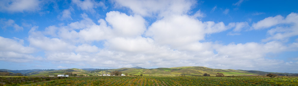
Yosemite Valley Hiking Trip: 5 June-7 June 2009
Day 1: Four Mile Trail, from Yosemite Valley to Glacier Point and back. 8.8 miles.
Day 2: Half Dome, from Yosemite Valley, via the JMT. ~18 miles.
Participants: 2
Friday June 5
This trip to Yosemite officially began around 2:15PM when I picked up my dad from the annual JavaOne software conference in San Francisco. I’d spent the morning at Foothill College in the dark room. After a false start (got on 80 west instead of east) we were crossing the bay, and traffic was moving well when we exited Oakland on highway 580 east.
Naturally that didn’t last, and there were numerous delays before we reached 5 and the central valley. Taking 120 east, we stopped just east of Manteca to pick up some fresh fruit and later in Oakdale for gas. Traffic tapered off as we reached the foothills, and when we reached the entrance to Yosemite National Park around 7PM, we were practically the only ones there.
Talking to the ranger at the entrance left us with a problem: all campsites in the park were ostensibly full (and most of those not in the valley were closed). After discussion, we decided to go down to the valley as originally planned, and hope to scavenge something. The drive down to the valley was pleasant, and we saw the tail-end of a colorful sunset over Half Dome.
Purely by chance, we found the backpacker’s camp as we drove our way through Upper Pines (reservation only) campground. Miraculously I found an unused spot while scouting, so I took it. Unloading the car was a bit of a nuisance, but we got everything out in two trips, and then I took the car to the official parking (more than half a mile away). Dinner was a freeze-dried meal with some extras (mainly fruit), in the dark. After a night of not so much sleep (packing), I was happy to turn in by 11PM.
Saturday June 6
Saturday began auspiciously enough with clear skies and a cool morning. Getting up around 7AM, we had a camp breakfast (instant oatmeal). The plan was to hike up to Glacier Point, and after wasting a bit of time deciding how to get to the trailhead, and arranging backpacks, we set off on the ‘Four Mile Trail’ (so-named because its main destination, Glacier Point, is nominally a mere 4.4 miles away) at 10AM. Already, the skies were an overcast white.
The trajectory of the FMT meant that we basically switchbacked up the southern wall of Yosemite Valley for the duration of the hike. The granite of the cliff made for a hard and often steep trail. The views for most of the way were obscured by trees, but by the second half, we had some nice looks out toward the Central Valley and across at Yosemite Falls. There were also plenty of wildflowers of varying colors. Perhaps on account of the weather, we didn’t see that many people on the trail until the very end.
It was half past noon when we reached Glacier Point. It was quite crowded with people (almost all of whom had driven up). Clouds had thickened and descended to the point that some were passing between us and the other side of the valley. It was actually quite cold. As each of us had 2 cameras, we took a fair number of photos. In spite of the crowd, we found a comfortable spot nearby to sit and contemplate the view. Glacier Point has what is of course one of the best views of Yosemite Valley, placed as it is opposite not only Yosemite Falls and the Merced River, but also Half Dome, Nevada Falls, and Little Yosemite. In spite of the clouds, much of Tenaya Gorge was also visible.
Having no afternoon plans, the descent was mostly a leisurely affair. Drizzle started about half an hour below Glacier Point. This came and went a few times, then turned to genuine rain. It rained steadily for the final hour of the hike. By the time we’d reached the trailhead at the bottom around 5PM, we were both pretty wet in spite of our raincoats.
Since further walking around the valley floor didn’t seem very exciting considering the conditions, we drove to Yosemite Village. There we explored the various concessions, went to the visitor center to obtain a rather pessimistic weather forecast for the following day, and managed to arrive at the Ansel Adams gallery 5 minutes after closing time.
The rain continued, so for dinner we decided to try the pizza place in Curry Village which I had hazy (but positive) recollections of visitng many years before. The place had apparently changed, for what we found was an incredibly crowded cafeteria, and a counter selling pizza (with a long line). Not impressed, we drove back to Yosemite Village to Degnan’s Loft which also served pizza but had the merits of offering a (dry) place to sit, and no long lines. The pizza turned out to be passable too.
When we returned to the campsite after parking the car around 9PM, the rain seemed to have paused. The tent was miraculously dry inside. Although the evening was warm, I had no trouble sleeping. The plan for the next day was Half Dome if weather looked good, and a long drive (over the Tioga Pass and north to Tahoe, before going home) if it did not.
Sunday June 7
Climbing Half Dome is one of those things that probably most of the people visiting Yosemite consider doing, and a surprising number actually do give it a try. This I suspect is partly because of the mountain’s iconic status as official Yosemite mascot, and partly because of its apparent accessibility, but whatever the actual reason, we certainly did not lack for company as we hiked up the peak for the second time in five years.
Of course, when we awoke around 5AM, there were doubts as to whether there was much of a point to the hike. Fortunately, the fickleness of the weather was in our favor, and the only evidence of the previous night’s rain was a very damp tent. Somehow, dismantling it, fetching the car, driving to the trailhead parking, and arranging daypacks took until just before 7AM.
The first half mile of trail took us from the parking to the actual trailhead at Happy Isles. From there, it was 0.8 miles along the rocky mountainside above the Merced River to the Vernal Falls footbridge. The sun was already up on the Ililouette gorge and Panorama cliffs, but we were shaded by the deep walls of the valley.
Opting for the longer route to Nevada Falls, we bypassed Vernal Falls itself, following the JMT’s switchbacks up the side of the valley. This did have the advantage of keeping us in the shade, and off of the steep stone steps of the Mist Trail. Further along, we had increasingly broad views of the Yosemite Valley, Nevada Falls, and the less-familiar backside of Half Dome. It took about an hour and a quarter, including a brief unscheduled shower beneath the Panorama Cliffs, to do the 2.5 miles from the junction to the falls.
Pausing just long enough to photograph a rainbow at the top of the waterfall, we continued (it was now 9AM) along the north bank of the Merced, climbing slightly before leveling off in a broad half-meadow keeping a few hundred yards from the river. People were plentiful. We began to also see hikers going (returning?) in the other direction.
At the junction near the Little Yosemite ranger station, our trail turned north, proceeding to climb steeply through pine forests of varying densities. The next two miles were excellent exercise as we ascended almost 2000 ft. in a little over an hour. A little past the junction with the trail to Cloud’s Rest (a hike for another day) we reached the ridge, and a bit further on, came out of the trees to excellent views of Tenaya Canyon, Half Dome (in profile), Little Yosemite Valley, and indeed much of the entire park. It’s a nice area, and I was more than happy to take a break and let my altitude induced headache dissipate.
Still, with gathering clouds (and crowds), we didn’t want to dilly dally. The nice flat ridge gave way to a not at all nice steep granite hump. While the path was easy enough to follow, it was all rock, varying between steps, and smooth granite. We found ourselves at the end of a group of some 20 people.
Undoubtedly the most famous part of the route up Half Dome is the cable section. This we reached a bit before noon. Anchored into the face of the mountain, two sets of cables about 4 ft. apart offer a good support up what would otherwise be a very steep and slightly exposed climb. It’s a pretty good system, assuming one doesn’t let go of the cables. If you stay between the two, you have grips and both sides, making the whole thing feel pretty secure. The downside is that while the whole stretch is short, it doesn’t take too many people stopping to rest (or because they’ve panicked) to block the whole thing.
At any rate, going up was a tiring, but not exhausting 20 minutes for us. The people in front were taking regular rests, so there was no point in hurrying, and there were plenty of people descending who we paused to let pass by. The arms actually took more of a beating than the legs, holding onto the cables (note that good gloves are a must).
As would be expected, the view from the top was impressive. The gathering clouds obscured things a bit, particularly to the north and east where Yosemite’s higher peaks remained cloaked in snow, but the view was still at least 20 miles in all directions. The only near point that is higher is Cloud’s Rest, at the other end of the same ridgeline. The valley of course is far below, although how good a look you can get depends on your nerves (5000 ft. is a long way down). Part of the summit is an overhang, which means that aside from 20 ft. of rock or so, you’re standing on thin air.
This being my second time on top, it wasn’t all new, but it didn’t need to be. We took photos. We ate lunch. We rested. We took more photos. Mostly we just soaked in the scene. There were at least another 30 people on the summit when we got there, and the number only grew. Finally, around 1:30PM, we were ready to begin the long (9 miles in fact) descent.
Going down the cables is actually harder than going up. For one thing, you can see exactly what it is you’re doing (and how far you can fall if you don’t do it right). For another, gravity makes getting secure footing a lot less trivial. The easy solution is to go down backwards, as you spare yourself the daunting view and tend to improve foot traction. We were actually going down at quite a nice pace, before reaching a blockage. Owing to the slope, it was hard to see exactly who it was who was blocking traffic. Whoever they were, they were evidently taking a long break. Eventually, people behind us began to get impatient, and go along the outside of the cables to pass. With no sign of the blockage clearing, we decided to follow suit. This was of course somewhat more dangerous as the footing tended to be steeper on the outside of the cables, and you had no option to hold on to cables on both sides. Happily, the remainder of the descent down the cables went smoothly (and rapidly).
From the bottom of the cables, we continued rapidly passing down the rocky section, along the ridgeline, and down into the pine forest below. We encountered a couple of deer on the ridge, and a buck in the forest, but actually didn’t see so many people. By 3:30PM we were at the junction near the Merced River in Little Yosemite. By 4, we had reached Nevada Falls. Clouds remained present, but most of the sky remained clear, and the afternoon sun was quite warm. We stopped at an overlook next to the falls to admire.
Going down the way we’d come up, we passed along the JMT’s traverse below the Panorama cliffs, got wet again, and then followed long switchbacks downward. I counted 26 switchbacks from Nevada Falls to the junction with the Mist Trail below Vernal Falls. At 6:15PM we crossed the footbridge. At 6:45PM we reached the trailhead. Just before that, we’d met a large group of kids (age 5-12, as well as 3 adults) carrying full packs who had spent the night in Little Yosemite. Finally, just before 7PM, we reached the parking lot.
Driving back to the bay area took nearly 5 hours. About the most exciting part was a delay near the park entrance, which turned out to be because a bunch of people had spotted a bear in the nearby meadow and pulled over. We continued on. By Manteca, I was getting sleepy, so we switched drivers. It was just past 1AM Monday morning when we reached home.