
Last weekend, me and my father joined a Sierra Club backpacking trip on the Lost Coast (between Mendocino and Eureka). It proved a neat 3-day trek along an isolated and gorgeous stretch of coastline.
Summary
Lost Coast PCS Backpacking Trip: 14 May-18 May 2009
Route: Lost Coast Trail, from Mattole River Trailhead (Lighthouse Rd., near Petrolia) to Black Sands Beach (near Shelter Cove). 24.6 miles over 3 days.
Participants: 6
Trip Report
Thursday 14 May
Sassan and I left Half Moon Bay a bit before 3PM after several hours of frantic packing. The plan was to beat the afternoon commute in the north bay and meet up with Tim and the rest of the group somewhere en route to Shelter Cove, the southern terminus of the hiking route. Driving north on Highway 1 with a detour along the Great Highway to avoid traffic, we found sun, preliminary preparations for Bay to Breakers and good view of Marin going through San Francisco. Continuing along 101, we had a few stretches of slow going through Santa Rosa but nothing to speak of beyond. Passing by Ukiah, we made a stop around 6PM in Willits at the unpleasantly large Safeway that had appeared there since my last visit (c. 1999). At least the nearby park retained a small town atmosphere, in addition to restrooms and an apparently quite popular playground.
North of Willits, 101 is called the ‘Redwood Highway’ and it accordingly narrowed and wended its way through the coastal range and its numerous large redwood forests. We passed swiftly through long stretches of open countryside, past odd little towns like Longvale, Laytonville, and Legett to Garberville. Since we were unable to reach the rest of the group, we opted to continue on as far as possible before camping for the night. Following the Shelter Cove Rd. from Garberville, it took almost an hour along narrow mountain roads to reach the turnoff for Nadelos campground, where we chose to spend the night. We had glimpses of a spectacular sunset along the way.
We had Nadelos, a tiny 4-site campground in the trees of the Kings Range (1820 ft.) almost to ourselves, and aside from the small creek and an occasional passing car, it was a quiet night. We called it a night around 10:30PM, after a quick dinner of whatever miscellaneous extra food proved most convenient.
Friday 15 May
Anxious to reach the rendezvous point on time, we were up at 6AM the next morning. Decamping and continuing along the increasingly steep road to Shelter Cove (first up, then down), we took the turnoff for Black Sands Beach and reached the parking just after 7. Two other members of the group, Naran and Punnit, were already there, and Tim and Andy arrived a few minutes later.
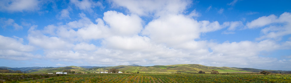
Leaving one car to serve as a shuttle, we all drove in the remaining two back up the road we had come toward Garberville. 20 minutes later, we reached the King Conservation Area ranger station, where we stopped for permits and advice. A very helpful ranger not only let us in well ahead of opening time but provided valuable recommendations regarding places to camp, tides, and the smelly remains of a decomposing whale partway down the route. Another 15 minutes past the ranger state, we took a left on Ettersburg Rd. which we spent nearly an hour on, covering 30 miles of narrow mountain road (including a brief but steep unpaved section) ending at the commune of Honeydew. Taking CA 211, west, we spent another half hour to reach Petrolia (population very little), where we took photos near the church and bought last minute foodstuffs and breakfast at the general store. Another quarter of an hour and we were near the mouth of the Mattole River at the end of Lighthouse Rd. and the start of the Lost Coast Trail. The usual hasty process of preparing packs and putting on boots ensued. We finally took a self-portrait and lumbered out of the parking and onto the trail just before 11AM.
The first stretches of the LCT going south (the only direction at that point) were along the beach in the sand, amid large numbers of sand-tolerant plants and flowers. The coastal fog was in the process of clearing and provided a very picturesque backdrop to the ocean. We were hardly the only ones starting out, and within the first half an hour must have passed (or been passed) by at least 15 people. As we continued toward the Punta Gorda lighthouse, there was a stiff breeze bombarding us with sand and small pebbles. A mile out from the trailhead, we reached our first creek and when stepping stones proved elusive, opted to switch to take off boots before crossing.
The next point of interest, near the 3 mile mark was the lighthouse. As the ranger had said, the ladder had recently been repaired, so I took the opportunity to climb the tower and snap a few photos, although the views from the adjacent hill were probably just as good. Unfortunately, Tim’s boots at this point were in the process of rapid dissolution. After a brief discussion, it was decided that he would go back to the trailhead (without pack) to fetch his regular shoes, Andy would wait with the pack, and the remaining 4 of us would continue on and get a campsite at the next main creek, 3 miles further on, where they would meet us later in the afternoon (and of course, we would make up for lost time the following day).
So we continued our march south. The trail left the beach not long after the lighthouse, climbing above the bluffs and cliffs and affording wide views to the north and south as the morning fog had essentially vanished. Wildflowers were plentiful. ‘Sea Lion rock’ proved to be exactly that, covered with a good number of quite audible sea lions. The trail dropped back down onto the beach once, before regaining the bluffs and reaching an intersection with the Cooskie Cutoff trail that led up the ridge and inland. Our path was, after a counterintuitive northward stretch, back down on the beach. The tide was about midway between low and high, and though the beaches were narrow, there was only one small spot where the waves needed to be worked around.
A little farther along the beach, we reached Cooskie Creek shortly after 3PM. A driftwood shelter had been constructed on the north side of the creek, just up against the cliff. A few hundred feet further inland past the main outcropping of the cliff were a number of flat grassy areas, and these we claimed as campsites. Dropping the packs, we ate a leisurely lunch near the mouth of the creek, and then lazed around on the beach reading, soaking up sun, or just resting. Other groups began to arrive and set up tents around 4PM. Feeling a bit bored, I opted to try and climb the hill behind the campsite in hopes of a view of the area. It was a pretty steep slope, and naturally the view remained just out of reach, so I continued up, stopping around 500 ft. above on a pleasant green meadow where a herd of cows were placidly grazing, in view of both the higher peaks of the King Range and the afternoon ocean. As usual, going down actually was a lot harder, and it took several false starts before I made it back down. A bit after 6PM, Tim (in his replacement-shoes) and Andy arrived.
We pitched camp fairly rapidly and immediately set about preparing dinner. Bread, cheese and freeze-dried ‘turkey tetrazini’ were the order of the evening for me. Others had considerably more interesting (and elaborate) food, which prompting a reassessment of what to bring for the next time. As the sun was setting, Andy, Sassan and I wandered out to the beach, where we watched the emergence of sunset colors and I finished the last half of my dinner. It may not have been the most spectacular sunset, but it was quite nice, and plenty of our (camping) neighbors were also out to watch. Then food was repacked (to secure it from the bears), packs were organized, and we all went to bed around 9:30PM. It was a little warm, but I slept well.
Saturday 16 May
Per the agreement to get up early so as to make up for the shortened first day, we were all up at 6:30AM. Breakfast was made and eaten quickly (oatmeal in many cases, including mine), tents were repacked, water was pumped, and a little after 8AM, we set off. The very first thing to do was cross Cooskie Creek (boots off) and then proceed down a long stretch of somewhat narrow beaches and high cliffs. There was a little morning haze which gave everything a soft look, but there was no wind to speak of, and the beaches themselves were all amazingly clean, with only the occasional shell or piece of seaweed for debris.
Two miles on, we reached Randall Creek, which we crossed in the usual way. From there, we followed the LCT up onto the bluffs and through huge fields of yellow poppies and other wildflowers. Mid-May must’ve been exactly the right time, for the colors and indeed the whole scene was nothing short of spectacular. As 5 of the 6 of us had cameras, progress slowed to a crawl. Two more miles and we were at Spanish Creek. Here, we found a number of logs and stones to cross by, and on the other side, an abandoned football.
We took a snack break at Spanish Creek, admiring the ocean, the sand dunes, the odd little cabin just south of us, and the huge quantities of driftwood laying all over, some it quite far from the ocean. The next stretch was more of the same, with the trail going above the beach and below steep hills and a partially destroyed pine forest (bark beetle or fire?). Another mile on, we crossed Oat Creek (stepping stones). A bit past that was Kinsey Creek. We met a northbound traveler on the other side. He and his dog (a large friendly golden retriever wearing appropriate paw-gear) had left Shelter Cove (13 miles south of us) early the same morning. We were impressed.
It was 2PM when we reached Big Creek, and after taking off the boots and wading across, we made it a lunch break. The trail beyond alternated between beach and blufftop, but the blufftop section appeared to be in the process of deteriorating, and we were mostly on the beach. We encountered a very unhappy looking seal pup (abandoned) on that beach. A bit further along, the trail climbed back up quite steeply, and we were temporarily surrounded by pine forest and the smell of warm sap. The sun was quite warm as we continued inland, separated by a quarter of a mile from the ocean’s breeze. We could see large pieces of driftwood resting far from the edge of bluffs. If this was not puzzling, the trail widened and straightened out thereafter and we could soon see a small aircraft in the distance. Closer inspection proved that this was not an optical illusion but in fact the preferred mode of transportation for a few lucky souls whose houses (they were far to fancy to be called cabins) were located on parcels deep in the midst of the Kings Range Conservation area. One of the houses had solar panels. A sprinkler system was active near another.
Slightly before 4PM we crossed Big Flat Creek and reached Miller Flat. Here we paused, discussed, and decided to attempt to continue on to Shipman Creek, in spite of the rising tide (high around 6PM) in order to shorten the next day’s hike. After a brief continuation on the bluffs, we were back on narrow rocky beaches, with the surf hissing around us. We continued on rapidly and covered the two miles to Shipman before 5PM, with no real trouble from the tide.
When we arrived at Shipman, most of the obvious campsites on the north bank had been taken, so we crossed and took the few remaining spots on the south side, sitting right on the beach (though with driftwood windbreaks). Tents were pitched. Dinner followed. Dinnertime conversation covered a wide array of topics. A bit before 8PM, Sassan and I chose to head south a bit further on the beach for a view of the sunset. We weren’t alone, as the heads of seals appeared and disappeared continuously in the water nearby. The sun set around 8:30PM, and we were all in our sleeping bags a bit after 9. There was no wind, which was actually too bad as it got quite warm during the night.
Sunday 17 May
Sunday morning began with the same routine as Saturday. By 8:30AM, we had breakfasted and broken camp. Half an hour south of Shipman, we encountered an explanation for the previous night’s seals in the form of several large rocks which more than a dozen of them were resting on (with others in the water). Also present was a small waterfall coming down through the trees, and a thin morning mist, which lent the area a slightly mysterious air. We made our way along the beach rapidly and it was not long after our photo break that we reached Buck Creek.
The final miles of trail to Shelter Cove were all along the beach. This made route-finding easy, but proved rather fatiguing. We took a pause after crossing Glitchell Creek on a log, and another one where Horse Mountain Creek should have been, although we didn’t find it. The beaches were wide and flat and long waves rolled up them incessantly. The sand was dark, and mostly rather coarse, like fine pebbles. In spite of the ocean, the temperature was quite warm. When we finally did reach Black Sands Beach and the little walkway up to the parking lot, we were all ready for a good rest. We reached the parking lot just after 1PM.
The car shuttle plan required fitting 5 people and 4 packs into Naran’s car. This we did, more or less comfortably, with Sassan being left at the beach with two packs, where I was to pick him up after getting the car. The rest would go back to 101 directly from the northern trailhead. The drive to the mouth of the Mattole River was nearly an hour and a half following the same route we’d taken on Friday morning. Inland, it was clearly a hot day, with temperatures in the mid-80s. Thanks to Naran’s excellent driving, I did not get even slightly car sick. A bit before 3PM, we rolled into the parking lot. There, we said our goodbyes, and I left immediately. I made a quick stop in Petrolia to pick up some ice and leave a note for a lady who had been my daycare provider when I was 2 years old in El Granada, before moving to the town.
The drive back to Shelter Cove took until a bit past 5PM. I picked up Sassan at the parking lot, and we were off towards Garberville where we paused for gas. We made excellent time going south on 101. At 9PM, we reached Ukiah, where we stopped to find a place for dinner. With the tip of a friendly local, we found the Ukiah Brewing Company which provided a nice solid meal to end the trip on. The place was an interesting mix of pub (fish ‘n chips) and new-age joint (organic curry tofu). From Ukiah south, we made no further stops. I dozed while Sassan drove and we reached Half Moon Bay a just after midnight.
Conclusion
We only covered half of the full Lost Coast Trail, but from what I saw, mid-May is exactly the right time to go. Wind can be a problem, but we lucked out and after Thursday encountered none to speak of. We had mostly clear (fogless) weather, without which things would have been much less interesting. The tides are another thing to keep in mind as parts of the route can be impassable in high tide, so a tide table was an important part of the planning. It was certainly a popular trail, but not truly crowded as I suspect things get later in the summer. The biggest advantage to visiting in mid-Spring was that the wildflowers were pretty much at their peak, and we passed through countless fields of them. While the route was almost entirely flat, there is a fair amount of walking on the sand and pebbles, and this can get tiring. Our route worked well as a relaxed 3-day trip.
Thanks goes to the trip leader whose organization ensured a smooth and pleasant trip, and all the participants whose excellent company made the whole thing great fun.