
Introduction
The Haute Route (Walker’s High Route or WHR in many books) is a roughly 130 mile walking route across the Pennine Alps of central France and western Switzerland. It begins in the French resort of Chamonix below Mont Blanc, the highest peak in the Alps, and concludes in the Swiss resort of Zermatt, beneath the Matterhorn, Switzerland’s most striking mountain. In between, it passes westward from valley to valley parallel to the spine of the Alps, offering dazzling mountain scenery, punctuated at frequent intervals by picturesque villages and towns. The route is well marked and requires no special equipment or guide. Unlike long-distance treks in the mountains in California, the Haute Route has plenty of hotels and mountain inns along the way, so one need not carry anything more substantial than a daypack. Unsurprisingly, it has also become quite a popular trip, and while it remains far less crowded than the nearby Tour du Mont Blanc, it does see plenty of traffic, especially in the middle of the summer.
Preparations
When to go is probably the biggest decision to make when planning the trip. Go too early and the snow will make crossing the higher passes quite difficult. Go too late and the weather turns cold and unpredictable. There’s also the issue of crowds during the high season (July and early August). Generally mid-June seems to be about the earliest that is feasible, and late September is the end of the season (many places will also close starting then). We chose early September and had no difficulty booking accommodations a few weeks before our trip.
Most people walking the Haute Route fly to Geneva. It is the closest major airport to Chamonix and Zermatt and linked to both via public transit. However the Swiss train system is comprehensive enough that other airports (e.g. Zurich) work well too. Train ticket prices being what they are, it’s often helpful to get a pass if you expect to use the trains more than once during your journey. The SBB’s ‘50% off for 30 days’ ticket worked quite well for us. Along the route, if you should need to skip a stage or get a head start, the Swiss Post bus is a great help. While service is not exceptionally frequent, the buses do make it to nearly every small town and village with a paved road. We made use of them several times during our trek.
Booking accommodations in the internet age is a lot simpler than it used to be. Most hotels are accessible for reservation through the usual internet portals. You can also call them directly though, with the advantage that unlike booking.com etc, most do not require a deposit, so canceling/rescheduling a reservation is not a big deal. The Swiss Alpine Club also operates a network of huts (refuges) in more remote areas, so one need not stay exclusively in towns. These provide basic lodging (small rooms or dormitory-style bunks) and meals and can be a nice place to exchange stories and information with other travelers. Some are located in very dramatic areas too – high up mountainsides, below glaciers and so forth. While we spent only one night in a hut, it was definitely a highlight of our trip.
In terms of gear to bring, a typical daypack plus an extra set of clothes should pretty much cover it. Trekking poles are nice, as some of the trails can be steep. One can get fancy and have a luggage service transport your suitcase from hotel to hotel, but we didn’t find it necessary. As for food, you can usually depend on a good breakfast at the hotels and huts. We had our dinners in restaurants mostly. Some hotels have the option of a fixed price dinner along with the room (‘half pension’) which works quite nicely. Beyond that, many of the towns have small grocery stores (Coop, Spar) and bakeries, so making your own lunch is quite easy. Indeed we found really good bread in even the most unassuming places.
Day 1 (9/4) – Chamonix to Argentiere (5.5 miles, 800 feet)
The first segment in most Haute Route itineraries is a short one. Starting from Chamonix, it follows the bottom of the valley through several villages to the small town of Argentiere. It’s a pleasant and relaxing walk. The main challenge is not losing the path at the many intersections and road crossings, but as long as you follow the main valley upstream, you’ll get where you need to eventually. There are a few viewpoints along the way, but the best views are probably from Chamonix itself, of the glaciers and slopes below Mont Blanc. This segment is short enough that one could reasonably combine it with the following segment in a single day.
Day 2 (9/5) – Argentiere to Trient via Col du Balme (10 miles, 3,000 feet)
The route from Argentiere to Trient crosses over the Col du Balme which marks the frontier between France and Switzerland. On a nice day, you’ve got excellent views of the Mont Blanc valley behind, and the Rhone river valley ahead. The trail climbs up steadily to the pass, which is also the site of a hut, a good spot for a picnic on a nice day, and shelter on a wet one. The descent to Trient is shorter and steeper, dipping into a forest before emerging in the charming and very small town of Trient. Trient is so small (only 2 hotels) that it is one of the few places where making advanced reservations may be necessary.
Day 3 (9/6) – Trient to Champex via Alp Bovine (10.5 miles, 3,500 feet)
To reach the little lakeside resort of Champex, there are two options: the upper route is a challenging path over the steep and rocky Fenetre d’Arpette with what I am told are spectacular vistas of glacier and mountains, or the lower route which is a more gentle traverse across alpine pastures and thin forests looking down and across the Rhone Valley. Even the easier lower route has some steep sections though. Because this segment is shared with the extremely popular Tour du Mont Blanc (TMB) route, you will likely see a lot of people on this day, most of them traveling in the opposite direction. We had wet weather on this segment and so stuck to the lower route. Even with clouds and fog, you can get great views down into the Rhone Valley. Around midway to Champex at Alp Bovine, there is a mountain restaurant which makes for a nice lunch/snack stop.
Day 4 (9/7) – Champex to Verbier via Le Chable (12 miles, 3,000 feet)
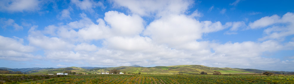
Perhaps the least ‘wild’ day in the whole trek, this section offers great views of the Swiss countryside, laid out like a miniature landscape diorama before you. Champex is perched well above the Val de Bagnes, so the journey begins with a long descent to the bottom of the valley, passing through a variety of farms and little towns to reach Sembrancher at the edge of the Dranse River. Then it follows the river upstream for several miles. Many itineraries end for the day in the medieval old town of Le Chable, but this makes for a fairly short day and a long climb the next day. An alternative is to continue on, making a steep ascent to the large skiing resort of Verbier. While lacking the charm of Le Chable, Verbier does provide great views of the valley. We chose to continue up to Verbier.
Day 5 (9/8) – Verbier to Cabane du Mont Fort (5 miles, 3,000 feet)
Between the Val de Bagnes and the Val des Dix, there are no small towns. It’s a long enough distance to basically require at least one night in an SAC hut. This is no bad thing – the Cabane du Mont Fort has tremendous views across the Val de Bagnes, including the white pyramid of the Grand Combin and on a clear day, the Mont Blanc massif. There are a couple of other huts that could be used too (further along). In our case, it began snowing as we left Verbier and we were quite happy to go no further than Mont Fort. Advanced reservations are a good idea with any of the huts, given the relatively small number of beds. The dining room in the hut is a great place to relax, exchange news with other travelers, and (if clear) admire the panorama unfolding right in front of you.
Day 6 (9/9) Cabane du Mount Fort to Lac des Dix via Col Termin (12 miles, 3,000 feet)
Sometimes referred to as the ‘three passes day’, this segment crosses the wildest and most remote areas of the whole trip. There is a high, partially-exposed traverse to the first pass (Col Termin), a long rough climb to the second (Col de la Chaux), and slightly confusing area where the path is lost among the giant boulders below the decaying Grand Desert glacier on the way up to the final pass (Col de Prafleuri). Most people end their day at the Cabane du Prafleuri, but we opted to continue on down to the shores of the Lac des Dix, and stay at the large hotel at the foot of the dam. Either way it’s one of the longer, more challenging days of the trek, but also a highlight in terms of scenery. Also note that the area below the glacier, while safe, does require some light scrambling and careful attention to the blazes that mark the route. Around the Cabane du Prafleuri keep an eye out for the elusive ibexes that sometimes graze nearby.
Day 7 (9/10) Lac des Dix to Arolla via Col de Riedmatten (12.5 miles, 2,800 feet)
To reach the mountain resort of Arolla, one must first pass around the large Lac des Dix. Formed as a result of a giant hydroelectric project, the Lac de Grand Dixence is a long narrow lake sitting between two steep ridges, with a wall of glacier and rock beyond its southern end. The first 5 miles of the route are basically level, traversing the west side of the lake (distance is shorter if one starts from Cabane du Prafleuri). Then the climb begins in earnest, first across lush meadows and then onto bare glacial moraines. There are two ways to cross the eastern ridge out of the Val des Dix – the Col de Riedmatten which requires a very steep climb up a narrow gully, and the Pas du Chat which involves climbing some large boulders to a series ladders that take you up to the pass. We took the first option. Happily the descent on the other side is a lot more reasonable. For much of the way down to Arolla, one can admire the Mont Collon sticking out of the sea of ice that is the Arolla Glacier. Arolla itself is quite small, but because of its role as a summertime resort, hotels and restaurants are plentiful.
Day 8 (9/11) Arolla to Evolene (8.6 miles, 1,000 feet)
After a couple of longer days, this short segment takes you down the Val d’Herens to the historic towns of Les Hauderes and Evolene. The route down the valley is pleasant, although it never strays too far from the road. A worthy detour which we took is the Lac Bleu with its sparkling waters and panoramic views back toward the Arolla glacier. It is possible to continue past Les Hauderes to the hamlet of La Sage to shorten the next day’s climb, though La Sage is small enough to make accommodations a bit trickier. We chose to stay at the bottom of the valley in Evolene, its narrow cobbled streets dotted with wooden chalets and copious geraniums.
Day 9 (9/12) La Sage to Lac du Moiry via Col de Torrent (10.5 miles, 4,000 feet)
It’s easy to run short on superlatives on the Haute Route, but the climb over the Col de Torrent not only offers some of the best views of the entire trek, but also has one of the best trails (quite unlike the previously crossed Col de Riedmatten). Whether one starts in Les Hauderes or La Sage (there’s a bus between), the first part is fairly steep, and nice to get done before the day gets too warm. As the trail climbs through one layer of pasture to the next, the views become steadily more expansive until at last they reach both ends of the Val d’Herens – the Rhone valley on one end and the Dent d’Herens peak on the other. From the pass, a whole new valley opens up on the other side, with the turquoise Lac du Moiry and a completely new constellation of peaks. The descent to the dam at the head of the lake is moderate by Swiss standards. From there one can either continue hiking down to Grimentz or take the bus. After a full day, we were happy for the bus (make sure not to miss the last one).
Day 10 (9/13) Lac du Moiry to Zinal via Col de Sorebois (6.5 miles, 2,000 feet)
The route to Zinal begins at the head of the Lac du Moiry with a short, steep climb. Happily it is much shorter than the previous day’s climb, and when the ridge finally arrives, it requires only a short detour to reach the Corne de Sorebois. From there, one has a tremendous 360 degree view of the surrounding mountains and valleys. On a clear day, one can the peaks on the other side of the Rhone Valley, separating Valais from the Bernese Oberland. To reach Zinal, one descends fairly steeply, although there is the option to take a gondola down instead after the initial part of the descent. While Zinal has plenty to offer hikers, we opted to take the bus to St. Luc to shorten the next day’s route. If one does stay in Zinal, one can continue the following day to the same pass we did.
Day 11 (9/14) St. Luc to Gruben via Forcletta (12 miles, 3,500 feet)
This stage begins in French-speaking Switzerland and ends in German-speaking Switzerland. To reach Gruben one can either go over the Meidpass, keeping close to the lifts of the St. Luc ski area, or traverse around to the smaller, less-used Forcletta. The Forcletta route is both longer and wilder, but it has nice views and offers a short detour to the Hotel Weisshorn, a grand old hotel with a long history and a reputation for blueberry tart, perched on a hillside more than 2,000 feet above the valley floor. The Forcletta itself is a narrow notch, but once you’ve begun the descent toward Gruben, the Weisshorn, Switzerland’s third-highest peak, comes into dramatic view. The Hotel Schwarzhorn is the only hotel in town, so reservations are advisable.
Day 12 (9/15) Gruben to St. Niklaus via Augstbordpass (11 miles, 3,500 feet)
The final stage to reach the valley of the Matterhorn inverts the typical formula by making a short steady climb to the Augstbordpass, followed by an interminable descent to St. Niklaus in the Zermatt valley below. The first part of the descent is particularly rocky, crossing one avalanche field after another. At the hamlet of Jungen there is a gondola down to St. Niklaus. Otherwise, it’s almost 6,000 feet descending from the pass to the town. Along the way down you are treated to expansive views of the valley and the high peaks of the Mischabel range directly across, but the Matterhorn remains just out of view.
Days 13 and 14 – Grachen to Europahutte and Europahutte to Zermatt
There are multiple ways to reach Zermatt from St. Niklaus. The most scenic and most difficult is a two stage panoramic traverse along the east side of the Mattertal. The primary challenges of this route are securing reservations at the Europahutte (the only accommodations near the midpoint of the route) and following the numerous detours around new and old rock slides. The most prominent of these slides requires a full descent to the valley floor, followed by a reascent. It is a lot of elevation on fairly rough terrain. A second much easier option involves walking along the valley floor the whole way to Zermatt, keeping close to the rail line. As our companions on this trip were limited in the number of vacation days, we skipped both possibilities in favor of the third, easiest option: taking the train from St. Niklaus.
Conclusion
If I have one piece of advice for future travelers of the Haute Route, it would be to take your time. There is so much to see and enjoy along the way that one could easily fill an additional week exploring side-paths and poking around in the towns and villages. Indeed I would go so far to say that if you have the luxury of visiting in the low season and not being too pressed for time, it is eminently possible to make the few necessary reservations over the phone (I’ve tried to mention them above) and for the rest, see where your feet and compass take you. Take this (and other sources) as suggestions, and make the journey your own.