
We were looking for an end-of-summer mountaineering trip in the high Sierra, and after examining and discarding several ideas, we were fortunate enough to find a Sierra Club trip to Mt. Brewer which we joined. The trip was my first real peak-climbing trip with the Peak Climbing Section.
Summary
Mt. Brewer PCS Trip: August 15-August 17 2008
Day 0: Driving to Cedar Grove
Day 1: Backpacking in to East Lake, and setting up camp there.
Day 2: Ascending Mt. Brewer (elev. 13576 ft.) via the class 2-3 route along the southeast slope.
Day 3: Packing out and driving home.
Participants: 6
Thursday 8/14
After spending much of the morning doing last minute hiking preparation (arranging backpacks and whatnot), I left to pick up Sassan in Cupertino. I also managed to replace the battery in my altimeter. Still not certain where we would be going, I learned via e-mail that although George was sick and wouldn’t be leading the PCS Mt. Brewer trip, Bill would be leading the hike and there was indeed space for two more. Weighing this against my less-than-completely-researched projected itineraries, we decided that a PCS hike would be both more practical and more fun. So I picked up Sassan around 4PM in Cupertino and we were off for Kings Canyon.
Traffic in San Jose wasn’t great, but making ample use of the carpool lanes on CA 85 (south) and then US 101, we did pretty well, save for a few hiccups near Gilroy. There we turned off onto CA 152 east. I had some trepidation thanks to the delay our previous trip there suffered (nearly an hour thanks to construction at the 156 junction). This time though, there were no delays to speak of, and we made good time, passing through Los Banos before 6PM. At the CA 99 junction, we turned south. In Fresno we exited onto CA 180 east. The last time we’d passed through had been some time back, and 180 was now a full-fledged 4-lane freeway (not entirely an improvement in our view). As the sun set, we continued up rapidly out of the Central Valley, arriving at the King Canyon National Park entrance not long after 8PM.
Cell-phone conversation with Bill confirmed that continuing on to Cedar Grove for an early Friday-morning start was the best option. We switched who was driving at Grant Grove, and continued along the winding road, first up over a 7000 ft. pass and then down to around 3000 ft. in the Kings Canyon. There was almost no car traffic on the stretch of road to Cedar Grove. Shortly after 9PM we reached Canyon View campground, where much to our surprise we found Bill and two of the hike’s other members, Colin and Jeff, just setting camp. We claimed a site, had a lengthy chat with the others about the next day’s plan, admired the many starts we’d not seen in some time, and after a quick cold dinner (that oddly involved a large amount of bing cherries) went to sleep, around 11PM.
Friday 8/15
In spite of the usual worry that it would be too warm for a good night’s sleep, things cooled off nicely, and it was actually chilly when we got up around 6AM. Camp was broken. Packs were arranged. And we were off to the Cedar Grove restaurant for breakfast. There we all met the hike’s 6th member, Larry, who’d left early that morning from Fresno. We had a hasty (but hot) breakfast at the restaurant, then made our way to Road’s End trailhead.
As usual, setting out took a little time. Getting the wilderness permit involved the usual lecture on camping practices, bears and whatnot (fortunately, the ranger was a nice a guy and didn’t belabor the points too much). The packs had to be rearranged too. When all was said and done, it was past 9AM when the 6 of us set off to begin the hike to East Lake where we’d spend the night before Saturday’s attempt on Mt. Brewer. Even in the early morning it was pretty warm. Still, we kept up a brisk pace, and reached the numerous crossings of Bubbs Creek and Paradise Creek around 10AM.
From there, the trail ascended in steep switchbacks. We’d started around 5000 ft. at the trailhead. The switchbacks took us up nearly 1000 ft, and afforded great views of the Cedar Grove valley (Kings Canyon) plus the adjacent Paradise Valley (Mist Falls was not, however, visible). Still, it was nearly 11AM when we had our first real break at the Sphinx Creek Junction, and we were happy for the rest.
Next, the trail continues along Bubbs Creek more or less continuously. The terrain changed a bit here and there, but it was mostly a steady climb. The packs obviously made things harder, so we kept a moderate pace. We had a short break around 6500ft. where Larry pumped water and Colin had a quick swim in the creek. Continuing on, we crossed Charlotte Creek around 1PM, and stopped for lunch. Meals had their usual variety, and when that was done, we pored over Larry’s excellent topo maps of the region (my maps were limited to a 1:100000 park map). Before leaving we pumped a little water.
Another hour and another thousand feet later had us passing through beautiful Summit Meadow and leaving the main trail. There is no bridge across Bubbs Creek there, so wading was in order. Fortunately being late August, this was manageable. Shoes were taken off, packs rearranged, and we made our way across the swiftly flowing creek. Although the water didn’t get quite to my knees, I was very happy to be using two poles in the endeavor.
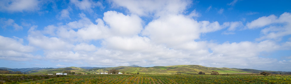
Indeed, the crossing was a pleasant diversion, helping us all cool off. It was 4:30PM when we set off again. The last 1000ft. of the day’s hike took us until nearly 6PM as we wended our way up first out of the Bubbs Creek valley and then along the broad slopes of this new valley, before finally ending up in steep switchbacks through the trees to reach East Lake (9300ft). The views of north toward Bubbs Creek were quite striking, prompting numerous pauses, as did a curious wooden bridge over East Creek.
East Lake proved an excellent place to camp. First, we were all pretty tired by the time we arrived. The lake however also provided the usual stream for pumping water (which I did almost immediately) and some gorgeous views. Mt. Brewer was faintly visible. The gather clouds, which happily did not result in rain, made for a stunning pinkish sunset.
Everybody set up camp rather quickly, arranging tents and whatnot, and then going to dinner. Some folks stuck to cold food while others used small stoves and freeze-dried food or pasta. I was in the latter camp, and was quite happy with the slightly soggy rice-pilaf that was the meal’s main course. Although we’d all brought bear cans (required), there was a bear box near the camp, so I had a chance to arrange the daypack for the next day as well, before calling it a night around 9PM. In spite of the day’s exertions, I didn’t sleep terribly well – mainly I think as a result of it being too warm, and the tent holding in rather more moisture than was comfortable.
Saturday 8/16
Per the plan made the night before, we were all up around 6AM. A quick (cold) breakfast, a stint pumping water, and we were off for Mt. Brewer. Jeff opted to for a more relaxed trip to Reflection Lake, but the rest of us set off from East Lake around half past 7.
Crossing the outlet of the lake was the first task, accomplished via logs and relying heavily on poles. We wound our way a bit around the south side of the lake, finally setting off cross country a bit before reaching Ouzel Creek (having already crossed a small unnamed creek earlier). Working our way up through the trees, we had a few false starts, but gradually emerged along a lowish ridgeline between the two creeks. Bill and Larry led, preventing us from getting boxed in by either of the two creeks. Bushes and trees made the stretch an occasional bushwhack.
Near 9AM we crossed the unknown creek to our right three times in quick succession around 9700 ft. At the first-crossing I even spotted a small rodent dashing in and out of the water. From the pictures, we later concluded it to be some manner of shrew or vole. After the creek, the trees were mostly gone and it was a straight-up slog along large granite shelves and hillocks, with occasional grass or small bushes. Progress was slow but steady with frequent pauses. We lost any semblance of shade after the last creek crossing, and the beautiful blue sky made for a decidedly warm ascent. On what was nominally the second shelf, the views opened up, including not only Mt. Brewer, but stretching all the way back down to Bubbs Creek and what appeared to be some sort of large fire (smoke) near Charlotte Lake.
With the peak dead-ahead around at around 10:30AM, near 10,500ft, we turned toward to the left to begin climbing a collection of increasingly steep boulders and rocks. I was becoming less optimistic at our chances of summiting at this point given the rocks and our seemingly slow rate of ascent. The last part in particular was quite steep, with occasional loose rocks, and definitely merited a class 3 rating in my estimation.
However, when we emerged onto the ridgeline a bit past 11:30AM above 11,700 ft., the views were quite spectacular, and while Brewer still appeared quite a climb, the whole thing appeared decidedly more manageable. Getting to the back side of Mt. Brewer was still quite a chore as the smooth ridge again gave way to steep loose rock. While only class 3, it wasn’t hard to see that the cliffs to our left were genuine technical-climb territory. The precariousness of the situation was punctuated when a large rock slide onto Colin’s foot. The heavy boots prevented serious harm, but he got a substantial bruise, and we were all a bit apprehensive after that. It was hot. We were slow. The climb seemed interminable. The altitude was no help at all. Some of us had doubts. Larry however was optimistic, and with his encouragement, we soldiered on.
Just before 1PM, the group (somewhat spread out) finally crossed over onto the back side of Brewer between (depending on whose altimeter you used) 12,600-13000 ft.). It wasn’t obvious whether the summit we saw was the real deal or not, but with time running low (turnaround was to be at 2PM) we made our way laboriously over huge loose rocks and up to the highest point in view. For once, the surprise was a pleasant one, as that summit, while 1 of 3 (and the other two looked really hairy to reach) was at least nearly as high as the others. All doubts were dispelled when Colin found the peak register. It was a bit after 1:30PM.
From the top of Mt. Brewer the views were superlative. You could see literally hundreds of the highest peaks in the Sierras (indeed on the descent, Larry pointed out Mt. Whitney which I’d not even noticed). The views encompassed easily 60+ miles in all directions, in spite of the haze. Kings Canyon (though not the bottom) was visible. The Palisades peeked over the horizon to the north. To the south were the Kaweahs and some of the most barren moonscapes I’ve yet seen. All-manner of lakes were present too.
Still, we now had a long descent ahead, and clouds were beginning to gather. So after snacks and photos, a bit before 2PM, we set off down the mountain. As feared, I found the first stretch of the descent, getting to the front-side of the mountain, even slower and more difficult than coming up. I gave up on carrying the poles and camera, fastening both to my still too-heavy pack (fortunately, not short on water, though 2L was the bare-minimum I’d recommend for this hike) and relying on (gloved) hands for balance and frequently support. On the front-side of the mountain, it was the same class 3 scramble as coming up.
With the weather looking increasingly dicey, Colin and Larry decided to go down quickly, and leaving the remaining 3 of us to continue at our slower pace. Unfortunately, we made a mistake trying to get off of the ridge-line into the Ouzel Creek bowl, getting off too soon. The resulting 40-minute detour was both exhausting, and nearly had us going down the class-4 stretch we’d seen going up. Correctly, Bill insisted this was not the way we’d come up, and so we regained the ridgeline to opt for a rockier but less obviously treacherous route. On the way back up though, a rock slid onto his leg, cutting it quite badly, We put makeshift bandages on it, but it still appeared to be bleeding, although he insisted that getting down quickly was more important than fixing the bandages.
So it was well-past 4PM when we reached the basin we’d climbed up from in the morning. We took a rest, but as the clouds began to provide a light hail, we quickly continued on. Down along a miniature-ridge between the two creeks once-again, we steadily worked our way down. Happily, the hail ended quickly, and the weather provided no further distraction. Still, once we reached the trees around 10,400 ft., the route became tricky, and we permanently lost the route we ascended on. We crossed the unnamed creek we’d crossed in the morning, but this time stuck to the more open areas just below smooth granite slopes, and then following a series of meadows down.
Completely exhausted, we emerged near East Lake well past 7PM. In the final surprise of the day, Sassan slipped off the logs crossing the lake’s outlet, getting quite wet. Back at camp, Colin and Larry had been resting (they had arrived around 2 hours earlier). Jeff had had a nice walk to Reflection Lake, and apparently met a bear near our camp (not bad for one’s first backpacking trip!).
We slowly prepared dinner, tried to help as Bill cleaned up his cut leg, and pumped yet more water for the next day. I was actually dehydrated, and as we’d not had much lunch to speak of, I was happy to eat most of a 2-person packet of lasagna, plus all the cheese and crackers allotted for the day’s hike, and a good-sized chunk of sausage. We agreed to set off for the trailhead the next day sometime after 8AM, and then called it a night around 9PM.
Sunday 8/17
Normally after an exhausting climb I sleep like the dead for a night, regardless of circumstances. Apparently the previous day’s climb wasn’t quite enough though, as the overly warm tent had me tossing and turning for quite a while before getting up around half past six. Nobody was in any great hurry to get going, so I had plenty of time to dismantle the tent, arrange the backpacks, have a hot breakfast of ‘quick’ oatmeal, take a few photographs of East Lake and pump another gallon of water from the creek (where I met my second shrew of the trip – funny little critter, that).
Larry wanted to get home early, so he disappeared down the trail toward Bubbs Creek at a brisk pace around 8AM, having said his goodbyes. The rest of us decamped on our own time, finally leaving the campsite for good just before 9AM beneath an impossibly blue sky. The switchbacks down were in the shade, but that ended soon enough, and by the time we had crossed the little bridge over East Creek out of the shadow of the ridge to the east, it was plenty warm.
Crossing Bubbs Creek was the same deal as coming up. We got there a bit past 10, took off our boots, and into the creek we went. Colin’s suggestion the Bill put his leg in a garbage bag to keep the bandages on it dry worked brilliantly. Soon we were drying on the north bank of the creek, chatting with a guy from the Department of the Interior whose job it was apparently to report on the status of bear boxes in the Sierra Nevada (whether they should be kept, or removed in favor of requiring canisters). Considering that the gig was slated to take 5 months and cover 1300 miles (on foot), he definitely seemed to have snagged one of best positions at the DoI.
The rest of the day’s route was along Bubbs Creek, and after pausing briefly in gorgeous Summit meadow around 11, we were plodding along again, staying happily beneath thin stands of pine and aspen for the most part. Shortly after noon, the group paused for a quick lunch near Charlotte Creek. It was good to be able to finish the cheese and crackers, leaving the bear canister remarkably empty. I also tried mixing some of the powdered fake lemonade with freshly pumped water.
Next was the stretch from Charlotte Creek to the Sphinx Creek bridge. While we went by occasional flowers and interesting plants, it was a hot, sunny hour-and-a-half we passed on the way to the junction. Of course, the dozen or so folks we saw going in the other direction had an even worse deal, ascending almost continuously in the same conditions. Still, it was mighty pleasant when we finally did take a break at 2PM under some pines, and I had a chance to splash some river-water on myself and drink almost a liter of pseudo-lemonade.
After Sphinx Creek were of course the switchbacks. Naturally, nobody managed to keep count, but we continued along at a brisk pace, losing elevation and admiring the Kings River Canyon, Paradise Valley, and a few innocuous-seeming clouds that had begun forming around the higher peaks. We reached the bottom of the valley floor a bit after 3, and doing the half-dozen crossings of the various components of the Kings River, fortunately with the benefit of bridges. Still, the shade didn’t last that long, and so most of the last, flat two-mile section was spent baking, and wondering whether the people heading in the other direction were overly dedicated or just plain crazy. Colin had the bright idea of taking a swim to cool off, but the rest of us just wanted to get to the trailhead and a bit after 4PM, we did.
Loading up the extremely hot cars with the equipment required the usual time and effort. From Road’s End, we all went to Cedar Grove to buy something cold to drink. Then Bill, Colin and Jeff said goodbye and our little group was officially disbanded around 5PM.
Unlike the drive in to Cedar Grove, the drive out was in bright daylight. We followed the road slowly as it first descended with the river into a deepening canyon, then climbed up and out into another valley, past the peculiarly located King Canyon Lodge, the Hume Lake cutoff, and the Grant Grove village. Descending toward the central valley on CA 180 was slowed a bit because we were in back of an ATV-towing camper, so that when we finally reached the bottom near Fresno, the setting sun was directly ahead.
In Fresno we paused to buy gas and rediscover the meaning of ‘warm’ in the central valley (97 degrees after 7PM). Next we took CA 99 north for a stretch, leaving it after 40 miles or so for CA 152 west. Happily, there were no major tie-ups and once on 152 the traffic eased considerably. From Los Banos on, I was more or less half-asleep (and, fortunately, not driving). We reached Gilroy around 10PM, took US 101 north, used CA 85 north to bypass San Jose, and forgetting that Sassan’s car was in Cupertino, continued to 280 north and 92 west to Half Moon Bay and finally arrived at home not long after 11PM.