Day 6 – Shap to Kirkby Stephen

DSC 5796

Wednesday June 22 – Shap to Kirkby Stephen – 20 miles

Most of our things were dry when we got up for breakfast, save for the boots. I tried not to have the full English breakfast, but largely failed. The weather was excellent when we met the others in the center of town. After a brief pause at the Coop market for some lunch materials, we were on our way.

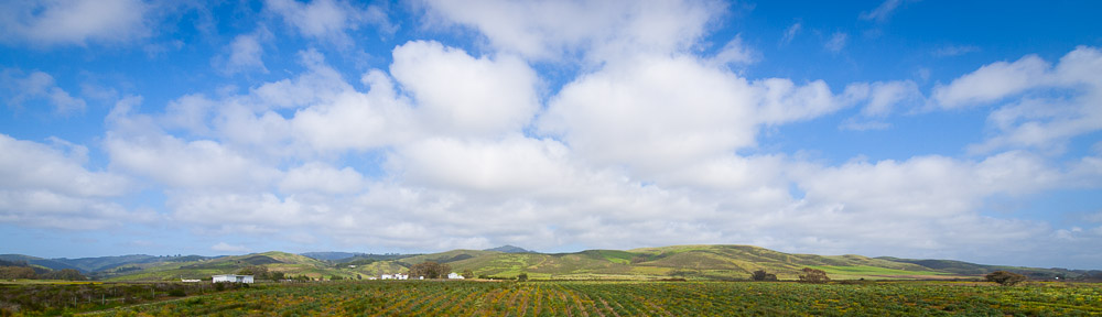
Our trail took us almost straight east from the start. The terrain was the flattest we’d seen so far, with no major mountains or steep hills within view. After 20 minutes, we reached the M6 motorway. Happily there was a pedestrian overpass for us to cross on. The trail led us through the pastures in the gently rolling hills and we made good time for the first part of the morning. I took advantage of the rainless morning to exercise the camera some.

Around 11:30AM, we bypassed the town of Orton in favor of a scenic country lane. When we found a farm advertising tea and desserts everybody was happy to take a break. There I ordered my first English cream tea. The desserts were pretty good too. Just around the time we sat down it had begun to rain, and we took shelter under a conveniently-placed awning.

We resumed our walk just as the rain stopped, passing among numerous farms and across field after field. To our north, a dark cloud seemed to hover, but for the time being it gave us no trouble. We took a couple of pauses for snacks but tried to keep a good pace to stay on track for our destination. As a result of the hurry, we ended up on the wrong side of a stone wall around 3PM. Unable to find a turnstile or crossing point, we descended down to a gate, where Mark explained Alfred Wainright’s approach to crossing barbed wire – place a jacket on the fence first, so that if anything gets damaged, it is your jacket and not something more important. We crossed the gate without incident.

We enjoyed lunch on the other side of the fence, but once we had finished, the black cloud to our north had moved to more or less occupy the entire sky. Under threat of rain, we hurried up the hill. First came a slight wind, then a few drops, then a few more, and by the time we were nearly at the ridge, a downpour was in progress.

The rain did not let up as we began our descent on the other side of the hill toward Kirkby Stephen. The fields we walked through rapidly turned into ponds with every little stream suddenly swelling to twice its normal size. One little stream that we delayed crossing had become so wide by the time we tried to gain the other bank that we had to go wading.

The final indignity came near a dairy farm. There the trail used an underpass to cross the railroad. The underpass was dry enough but at the other side we were faced with about 30 cows staring at us. The only path they left us was a deep brown pond that smelled freshly fertilized. Still, if you are going to pass through a muddy pond full of cow poop, best to do it while it’s raining heavily. The rain cleaned the smell and anything else off our boots in no time.

We reached Kirkby Stephen a little after 6PM. The rain which had abated slightly was back to its torrential best. Bob, Sassan and I wished our friends a good night, and ran for our hotel. The Black Bull did not unfortunately have a drying area, but with a generous donation of newspaper and liberal use of the heater and hairdryer we managed to mostly get dry. Dinner we ate downstairs in the pub, happy not to have to face any more rain for the day. I had fish cakes which were excellent, but I would have been happy with anything that was warm and cooked.

Day 5 – Patterdale to Shap

P6217585

Tuesday June 21 – Patterdale to Shap – 16 miles

Breakfast was a simple but substantial affair at the hostel. After we had deposited our luggage in the lobby, we began our walk down the main road toward to the White Lion. Already it was drizzling. We stopped at the general store, which proved quite well equipped for hikers. The prognosis for the day’s weather wasn’t looking too good.

We started off once again a little before 10AM, having been slightly delayed by the process of purchasing sandwiches (packed lunches) for the day. Our trail skirted the town and after a short while we were steadily ascending in the generally easterly direction of Kidsty Pike. As we went up, the fog came down. Once we were firmly ensconced in a thick bank of fog, the rain began. Then came the rain.

With visibility limited to 20 feet and rain coming down at all sort of inconvenient angles, the walk became primarily a matter of keeping in eyesight of the person in front. We climbed a fair amount, but thanks to the wind and cold nobody was interested in taking a break. Once we were near the ridge, we met several other groups. They didn’t look any drier than we did. We did make one stop after a junction, and waited nearly 10 minutes for the other half of the group to rejoin us. They had taken a wrong turn and nearly headed back toward Patterdale.

We reached the high point of the day, Kidsty Pike, around noon. There was no view. A few people put on rain pants, but I didn’t both as I was already thoroughly soaked. Descending from Kidsty Pike my visibility was further reduced by rain on my glasses, but somehow or other I managed to keep within eyeshot of the group. The weather did slowly improve after we began our downward walk.

Eventually the rain did stop, and we were greeted with a view of the Haweswater Reservoir, at the bottom of the next valley. There was a road on the far side of the reservoir, but on our side, there was only a trail and an occasional fence. We stopped at a junction just above the reservoir and had a quick lunch. Naturally, it began to rain again as we were finishing.

The walk around the reservoir appeared from a distance to be a flat one. This of course proved to be an illusion, as the trail proceeded to climb and drop continuously as it skirted boulders, forests and whatnot. By the end of the 4 miles around the reservoir, my sodden feet were beginning to get quite blistered. Still, the views were quite unique, including the dam at the head of the valley, and the fog lent everything an air of mystery.

Past the head of the dam, the terrain flattened out. Steep valleys and ridges turned to gently rolling hills, and the rocks and boulders were replaced once more with rolling grasslands. Far to our east, we could begin to make out roads and villages. The sun too decided that this would be an appropriate point to make a reappearance.

Our route to Shap passed through a bewildering array of fences, turnstiles and unmarked junctions. Fortunately, Chris and Mark had good maps and we did not end up having to make any detours. After a particularly nice meadow, we proceeded alongside a small creek and found ourselves face to face with the ruins of an old building. This proved to be Shap Abbey, a great church establishment in the Middle Ages that had fallen afoul of Henry VIII’s feud with the Catholic Church. Some parts, particularly one of the towers, were still intact, and we spent a pleasant half hour exploring the remains of the building and soaking in the afternoon sun.

The final 2 miles were fairly uneventful, save for a pause in the middle of a field where Mark found a sheep stuck on its back with its legs in the air. Once in such a situation, sheep apparently cannot right themselves, and are liable to die of thirst if not assisted. With one quick movement, he grabbed the back of the sheep and rotated it to its feet. The sheep seemed a bit shocked by the whole proceeding, but was happy enough to resume its normal routine.

We reached Shap after 6PM. It proved to be not so much a town as a single street lined with shops, houses and small courts, and stretching over a mile in length. Thus it took almost 20 minutes for us to reach our hotel, The Kings Arms, more than twice as long as the rest of the group took to reach theirs. Aside from being right next to the main road, it seemed a good spot, and we were happy to see that they had a good drying room.

For dinner we all met at the Greyhound Pub, a place heavily recommended by the guys we’d met at the youth hostel the night before. The Greyhound was actually rather upscale for a pub, but nobody complained. In an effort to enjoy something local, I had a lamb burger for dinner. It was a good choice. We also saw a couple of folks we’d seen on previous days hikes in the bar. When we left the pub to return to our hotel, it was raining again. We ran the ¼ mile to the Kings Arms.

Day 4 – Grasmere to Patterdale

P6207470

Monday June 20 – Grasmere to Patterdale

Nobody was in too much of a hurry in the morning. The weather looked nice, with no sign of the previous days’ rains, save for a few puddles. Breakfast, like dinner, was a significant affair. I had conventional fare, but most of the group decided to try haddock. When we set off a little before 10AM, the sky overhead was clear and blue and it was actually feeling a touch on the warm side.

We followed the main road out of Grasmere for about half a mile before turning off. The road was full of cars on their way to or from Grasmere. The trail took us up through hillsides covered in bracken and to the right of the valley that led to Griesdale Tarn. As we climbed, our view of Grasmere and the surrounding valleys expanded, but so did the tiny clouds overhead. It took nearly 2 hours to reach the tarn, by which point the blue skies had largely been replaced by gray.

At the tarn, the group split up, with Bridget, Michelle and Sassan taking the southern route and Chris, Mark, Bob and I heading to the north side of the source of Goldrill Beck. After the tarn, our trail immediately turned into a series of steep switchbacks. At the top of Dollywagon Pike, the ridge broadened as did our views. We could see Helvellyn, England’s third highest peak, just up the ridge ahead of us. The trail there was a gentle traverse with a small ascent near the end.

From Helvellyn, we had an excellent view of the Lakes District. Below and before us were the Ullswater, Patterdale, and the sharp edge of the Striding Edge (ridge). Behind us were Grasmere and numerous other little towns, as well as several lakes. To the west we could just make out the coast. To the northwest, we could even see a long cape of land that Mark indicated was part of Scotland. It was quite a sight.

We ate our quick lunch on the eastern edge of the peak, staring down at Striding Edge, and admiring as people seemed to climb straight up the near-vertical hillside to the top of Helvellyn.

The immediate after-lunch descent was precipitous. The trail did switchback, but it was still a steep and rocky way down. Once we were down the top 100m, we were at the beginning of Striding Edge. There one had a choice to climb along the ridge, a mass of class 2 and 3 rocks and boulders with considerable exposure, or to follow the narrow trail that yoyod up and down between gullies and cliffs. I tried the ridge for a bit, then opted for the trail. The rest of the group stuck to the ridge.

After ¼ mile the ridge slowly began to broaden. We all took the trail from that point. The clouds in the sky had ceased to grow and the sun actually returned when we crossed the ridge for the last time to get our view of Patterdale. Getting down to Patterdale took a decent amount of time, and as Chris and I were stopping for photos, Mark and Bob zoomed ahead. When we reached the bottom, flower-filled pastures had replaced the steep hillsides and boulders we had seen above. The sun was also out again, and the air was warm and full of insects.

The last stretch to Patterdale took us in and out of a small wood, across a bog and finally down onto the main road. It wasn’t hard to find Mark and Bob – they were seated at an outdoor table next to the White Lion Pub & Inn enjoying a few pints of the local ‘Black Sheep’ ale. I explored Patterdale a bit, before joining them to wait for the others.

Patterdale proved yet another small town, with one pub, one hotel, one general store and a youth hostel, but not much else. It was situated on a hillside slightly above the Ullswater, with views down and across that lake. When the others arrived after a pleasant but uneventful trip via the other ridge, Bob, Sassan and I left to go to the Youth Hostel where we were to spend the night. This was a much larger affair than the place we’d stayed 2 nights before, and we were lodged in a large common room with a dozen beds. While we were unpacking and organizing two gentleman we’d seen before came in, and we learned they were doing the hike east-to-west (opposite us), but doing the legs from west to east, using two cars to transport themselves and their gear. A complicated arrangement.

For dinner, we rejoined the others at the White Lion. The place was almost completely full and after a few pints, everybody seemed quite lively. Having not quite learned my lesson, I had vegetable lasagna which seemed biased heavily against the vegetables and in favor of the cheese. We walked back to the hostel around 10PM and I had no difficulty falling asleep.

Day 3 – Longthwaite to Grasmere

DSC 5710

Sunday June 19 – Longthwaite to Grasmere (8.5 miles)

When we awoke for breakfast, it was raining. It was still raining when we set off from the Honister Youth Hostel for Longthwaite an hour and a half later. We managed to avoid walking along the main road down from the pass, instead descending via a hillside trail. While the route looked obvious on the map, it was a little more complicated in practice, and when we saw a small town below, we immediately took the first path that looked to take us down the hill. But the hamlet we arrived in didn’t appear to have our friends’ accommodation in it, so puzzled, we continued on. Half a mile later, we arrived in the correct town.

At the Borrowdale Youth Hostel, we found Michelle and Mark, but Bridget and Chris were off looking at the ancient yew trees nearby, so we waited a bit a the hostel and watched the rain falling. It was almost 11AM when we set all set off from the hostel for Patterdale. It was still raining.

Our route took us down through two other tiny villages. In one, we found an open shop and bought some cheese (not local, but it was the only thing they had). Then our trail took a sharp right, to beginning ascending one of the subsidiary valleys. The landscape consisted of sloping fields, occasional trees and more than a few streams bounding down from the hills above. Most striking however were the stone fences that criss-crossed the seemingly otherwise untouched hillsides. The sheer amount of effort required to put together just a small section of these fences was hard to wrap one’s head around.

The trail took us steadily upward. Michelle and Mark were ahead of us, preferring not to take any pauses given how cold the rain was making things. We followed, with occasional pauses. The trail gradually left the right bank of the Langstreth Beck which it had followed, then climbed steeply toward a pass. With the rain and low-lying fog we discovered the pass wasn’t really any such thing, and there was another ascent through what was effectively becoming a bog to reach the actual pass. All of us were cold and quite wet when we arrived at the saddle around 1PM. Michelle and Mark were finishing lunch just on the other side.

Since the rain had mostly stopped, we took our lunch break on the pass too. Indeed, we saw a few beams of sunlight break through the clouds on the valley below. After lunch, we began the long descent toward Grasmere. The valley was fairly wide, and we followed the trail down as it crisscrossed between streams and among boulders. The rain had made things slippery too, so we took our time. At length, the valley began to flatten out and we encountered first sheep, then some dilapidated stone sheds, and eventually a few farms.

We followed the Langdale Beck down toward Grasmere for much of the afternoon. Once we left the upper section, the rocks and boulders gave way to lush pastures full of wildflowers. The steeper hillsides were heavily forested. The trail became a road, and the road deposited us in central Grasmere.

Grasmere was by far the largest town we’d encountered since leaving Kirkby Stephen. The main streets were filled with people, and we stopped in a café for some hot drinks and watched them pass by for a while. Then we headed off to check in at the Oak Bank Hotel. Unlike the previous nights, this was a fairly luxurious affair, with a cozy sitting room and a large dining room. We spent some time drying off and relaxing before reconvening for dinner around 8PM.

Dinner at the hotel was an elaborate affair consisting of 4 courses. I don’t remember quite what I had, but the meal included a sea bass main course, quail eggs as part of the starter, and a pretty good salad. Dessert was nice too. Of course as we were celebrating the birthdays of Bridget and Chris, it was only appropriate to have such a meal on that day!

After dinner, Chris, Bob, Sassan and I took a little walk to see Wordsworth’s cottage. The famous poet had lived in the town for a good portion of his life, and we were anxious to see his home. It proved a substantial building, much larger than the image the term ‘cottage’ signified to me. In spite of the near-darkness, we also managed to locate his grave in the cemetery. After the soggy day and big dinner, we slept well.

Day 2 – Ennerdale Bridge to Longthwaite (Honister)

P6187178

Saturday June 18 – Ennerdale Bridge to Longthwaite via Red Pike (16.5 miles)

When I got up at 7AM, things seemed to have returned to normal. Electricity was restored and everybody was getting prepared for breakfast. S, Bob and I had stayed in the ‘bunkhouse’ portion of the farm, essentially a large room with a dozen beds in it. It had worked out quite nicely really.

Breakfast was the real deal. While I didn’t quite have the traditional ‘Full English breakfast’, it was still more than enough – toast, marmalade, hash browns, poached eggs, sausages and several other things I must be forgetting. Then we had to repack our bags for the luggage service before setting off. The proprietor of the farm, despite the long night (the electrician had come at 1AM, and he had been up again at 5), was quite friendly and philosophical about the whole thing. We learned that the farm included not only sheep and crops, but a riding school and the horses we’d seen on the hike the day before. He was evidently used to long days in the summer!

It was nearly 10AM by the time we had begun walking down the hill toward Ennerdale Bridge. This time we made no stops, continuing past a stream and an old mill to a trail on the south side of the Ennerdale Water, a large lake occupying most of the narrow valley we were to walk through. Unlike the previous day, there was little sign of civilization once we left town, and the trail skirted boulders and small stands of trees as it steadily traversed around the lake. We passed Robin Hood’s chair which afforded a nice view of the valley.

Beyond the lake, the trail continued up the valley, through a forest under the management of the local forestry council. We didn’t see any wildlife, but a few hundred yards from their office we did meet first a chicken and then a rather friendly cat. It was a little after noon and at this point the group split. Bridget, Michelle, Mark and Sassan opted to take the standard route, while Chris, Bob and I decided to try the high route, via Red Pike and the ridge. The weather was cool and mostly overcast, but not overtly threatening of rain.

Our route immediately began climbing steeply for the ridge. The trail passed through a combination of ferns and bushes, and we saw a decent number of sheep as well. After nearly an hour, we left the bracken for grass and reached the ridge. We had occasional views, but a low fog was blowing by as well. We encountered a good number of people on top of Red Pike. We couldn’t see too much because of the fog, so after a snack break, we continued along the ridge. Through gaps in the fog we could see down both the valley of Ennerdale and the adjacent valley containing Buttermere.

The ridge walk was quite rocky belying the impression I had had of English hills as gentle and rolling. We passed 2 other summits, pausing for photos on each and reaching an elevation of more than 800 meters before making a very steep descent down more than 300m only to begin climbing a set of jumbled rocks and hills known as Haystacks. In a few places the trail gave way to boulders and we had to simply haul ourselves up on them.

The view from the top of Haystacks was quite expansive, including two valleys, several long ridges and a great deal more. Our trail continued along the ridge, past several little tarns before finally leaving the ridge to cross the watershed and climb the next ridge on the left toward the remnants of the old slate mine. We rejoined the main trail near an old structure built entirely from flat rocks, and after reaching the top began our descent following the same route as the now dismantled tram line to the mine.

It took about half an hour to descend to the slate mine, and our timing was exactly right, for the rain that had been threatened for much of the afternoon had finally arrived. We ducked into the Honister slate mine’s gift shop for a bit before the half of the group headed for Longthwaite began their last leg. Bob, Sassan and I remained as we were staying at the adjacent youth hostel, a few hundred feet away.

The Youth Hostel Assocation’s building was a well appointed one with a good view of the surrounding area. We had (for a price) gotten our own room. Checking in involved a slightly bewildering array of choices, from what dinner meal we wanted to have, to what our breakfast was to be the next morning (and of course when). Still, once we were settled it proved a comfortable area. Our room had a view of the hillside and we could admire the sheep as they wandered to and fro methodically clipping the grass with their mouths.

In spite of the complicated procedures, dinner was actually a very simple affair. The food was decent, but it was clear that everything was being more or less prepared the same way, which made all the fuss doubly puzzling. I went to bed shortly after dinner. None of us were feeling sufficiently energetic for an after-dinner walk down the hill to Longthwaite.

Day 1 – St. Bees to Ennerdale Bridge

DSC 5389

Friday June 17 – St. Bees to Ennerdale Bridge (14 miles)

We awoke at 6AM after a shortish night. It was already quite light out, thanks to our northern latitude and we quickly finished packing, leaving one bag behind and setting the other down in the hotel lobby to be picked up by the luggage service. After a short wait in the sunlight by the bus stop, the Penrith bus arrived and 5 minutes later deposited us at the train station at the far end of town. Soon we were passing rapidly through the Cumbrian countryside, headed north on the 7:40AM train to Carlisle.

We arrived in Carlisle just before the next west coast-bound train left, but we didn’t find the right track until it after was gone. So left with an hour to wait, we walked through the pleasant old town in search of a bakery. Breakfast was had at the train station café. Finally around 9:30, we boarded the train for St. Bees.

As we headed south and west toward the coast, the weather got progressively worse. Morning sun was replaced by darkening clouds. The seashore looked beautiful and dramatic, but before we had reached St. Bees rain had started again. We did receive some encouraging words from a fellow passenger who had come down for the day from Edinburgh wearing shorts.

Once we had left the train at St. Bees, we bundled into rain gear, and after asking for directions to the coast, headed straight along the main road up a hill. This proved a mistake, as in addition to encountering a fair amount of traffic, we apparently bypassed the first section to the hike. We didn’t realize this until after nearly an hour when we met some fellow hikers. The arrangement was to meet the rest of our group (who had taken the bus from Kirkby Stephen) above the beach, so we decided to follow the trail in the opposite direction as our route, in hopes of finding them.

We crossed a number of fields, passed through the little town of Sandwith and after some debate as to which way the trail went, reached the sea just above a large quarry. There, to our relief we found the rest of the group. After retracing our steps to the main road we continued eastward. The rain slackened in the early afternoon, so we had a brief lunch in a field within view of the rail line before taking the trail onto the route of a dismantled rail line that now served as a bike path. We met several other groups along the way beginning the same hike as us.

At length the route took us through the edge of Cleator Moor and then left the town and fields to climb steeply up a wooded hillside for the first major exertion of the day. We reached the top of the hill around 3PM and were afforded wide views of the surrounding area as well as the sea. Our break was cut short by a sudden outburst of rain, driven into our faces by the stiff wind.

The descent was surprisingly steep, but when we reached the bottom of the next valley, the rain had stopped, and we were treated to snacks prepared by Chris and B’s mother. Then it was up another little valley where we passed a large group of horses before turning off the main route to arrive at a large farm where we would spend the night.

The first priority, as would become routine over the next 2 weeks, was to get dry. Once this was accomplished, there was dinner to figure out. The English contingent of our group had reservations for dinner at the farm. The other 3 of us had not, so we decided to walk down the hill to the town of Ennerdale Bridge. We wound up at the Fox and Hounds Pub in the center of what was a very pleasant, but quite small town.

The pub was a popular spot. In addition to a few other hikers, there were plenty of locals. There I learned that in a pub one must order at the bar and that unlike American bars, pubs actually have a fair selection of food. I had lasagna, which was good save for the fact that nearly half the dish was cheese! Bob said the beer was quite good too. Just as we were planning on leaving Chris and Mark arrived in search of a drink, having finished dinner at the farm. So we hung around for a bit. Mark was interested in seeing what the town’s other pub had to offer, so before returning we had a wander through town, and everybody had another pint at the Shepherd’s Arms. There was still plenty of light as we trudged back up the hill to the farm, well after 10PM.

I was in the restroom brushing my teeth a little while later when the lights went off. We quickly discovered that the power for the entire farm was off. It turned out that the power strip that Sassan had brought along as a way to charge camera batteries and cell phones had a surge protector in it, and rather than protecting against a surge, had caused one. Not only that, but the power at the two neighboring houses had also been disabled. When I went to bed soon after, the proprietor of the farm was arguing on the phone with the electric company. It had been a full first day.

Day 0 – Getting to the start

P6167074

Wednesday June 15 and Thursday June 16 – Getting to Kirkby Stephen

As with many trips I’ve been on, this trip started out late and in a bit of a hurry. Last minute errands lead to last minute packing, so Sassan and I didn’t leave for the airport until less than 2 hours before our flight to London was to depart. We figured SFO wouldn’t be too crowded at 2PM on a weekday afternoon. We were wrong.

After several false starts that had us waiting in line at the wrong terminal, we finally found the correct luggage check-in counter, and were greeted with a line of approximately 500 people also waiting to check in their luggage. Clearly simply waiting was not going to work, so I found the nearest airline representative and told him our flight was going to leave in 20 minutes. He wasn’t especially sympathetic, but after he had successfully made his point about how we should have known better, should have gone to the right terminal and so forth, he did check in our bags for us. We rushed to the security line, got through reasonably quickly, and ran through the terminal to the gate just as the PA system was announcing last call. We were the last two people onto the plane.

The flight itself was comparatively relaxed. A few hours in, the clouds below cleared up and we were greeted with a nice view of the Great Plains. Closer inspection showed that a number of rivers had expanded beyond their customary boundaries, engulfing fields, staining the landscape a muddy brown, and submerging major roads in impressive fashion. I napped fitfully over the Atlantic, watched a singularly stupid movie, and finally awoke to see the southern portion of Ireland pass below. We arrived at London’s Heathrow airport around 7AM local time.

We found Bob without too much trouble at the coffee shop in the neighboring terminal. Heathrow was big enough that it required a 10 minute monorail ride just to get from one terminal to another. From Heathrow we took the London Underground (the ‘tube’) across town to Kings Cross Station. It took nearly an hour to pass through the 20+ stops in between. Kings Cross proved a busy but surprisingly small train station that bore little resemblance to the version in the Harry Potter movies (later we learned those were filmed at the neighboring St. Pancras station). It was raining outside and we had a collection of heavy luggage, so we waited in the train station until just after noon for our train.

From Kings Cross, we took the train to Leeds. It was a fairly fast train and in a little more than an hour we were deposited at the station there. In between, we were treated to various bits of England’s towns and countryside. It was raining fairly insistently when we left London, but the weather improved as we headed north. At Leeds, we transferred to a much smaller train. Soon we were passing through gently rolling hills, treated to beautiful views as we passed from one little town to another. At one point, the ticket collector, noticing our cameras, told us of a scenic viaduct shortly ahead. He was right – it was quite a sight.

At length we arrived in Kirkby Stephen, our destination for the night. Our first discovery was that the station and town were about a mile apart. So we sat in the café at the lovingly restored station (a ‘heritage’ station, part of the corresponding ‘heritage’ railway line) and drank tea while awaiting the bus into town. The bus dropped us at our hotel, a pleasant establishment called The Kings Arms which also featured a restaurant and bar.

After a brief rest, we set out to explore the town on foot. Chris and the rest of the group hadn’t arrived yet, so we made it down the main road as far as the brewery before turning back. Imaging our surprise when halfway back to the hotel a car pulled up alongside us with none other than Chris and Bridget inside. We greeted them and Michelle and Mark (who had by then also arrived) at their B&B and after some deliberation elected to eat dinner at The Kings Arms (it was recommended in Chris’s book). The 7 of us enjoyed a good meal at the restaurant. We made a plan for the following morning as half the group was going to the start of the route with the luggage bus while Bob, Sassan and I were taking the train. Then, at long last, we succumbed to jet lag and headed for bed. It was past 10PM GMT and the sun had still not yet set.

Day 0 – Preparing for the Coast to Coast walk


Preparations

The Coast to Coast walk across England is one of the most popular long distance treks in the country. Popularized by the famous walker and author Alfred Wainright in his 1973 book of the same title, the route crosses the beautiful countryside of northern England. Starting at St. Bees on the Irish Sea, it covers some 200 miles, crossing the Lake District, the Yorkshire Dales and the Yorkshire Moors to end at Robin’s Bay by the North Sea.

Several members of our local hiking club had done the Coast to Coast walk as part of a guided tour in previous years and recommended it highly. Their reports piqued our interest. It was Chris who finally committed to doing the trip in early 2011 as a self-guided trek. Three of friends from the UK wanted to do the trip too. When he asked if Bob, Sassan and I were interested in joining, we naturally said yes!

The first major challenge was to settle on an itinerary. Chris had a good guidebook and after some consultation we elected to split the trip up into 14 stages. This meant that each leg of the trip was between 9 and 20 miles. Based on everyone’s availability, we scheduled the journey for the last two weeks of June. This also corresponded with the guidebook indicated was the best time for walking, weather-wise. Plane tickets and transportation to and from the starting point also took time to arrange. In retrospect we would have done better booking in March rather than in early May (plane ticket prices increased substantially in the interim).

Michelle booked accommodations in February for the UK-based contingent. Since each leg of the journey was between small towns or villages, we had a choice of (in order of price) B&Bs, youth hostels, bunkhouses (exactly what they sounded like) and camping. Owing to the famously wet weather, we ruled out camping except as a last resort. I didn’t book accommodations for Bob, Sassan and myself until the beginning of May, so we didn’t have as many choices as M, but between B&Bs, hostels and bunkhouses, I found a spot for every night, and all but two nights in the same town as the rest of the group. Prices varied, but the usual price for a double-occupancy room in a B&B was around £60 (including breakfast).

The other important bit of logistics was arranging luggage transport. There were several services for taking luggage from one stopping point to the next, allowing you to only carry a light daypack throughout the trek. You provide them your itinerary, and they take care of the rest. We used the Coast-to-Coast Packhorse, and the service proved invaluable. No, it wasn’t cheap, but being able to have several extra sets of dry (and clean) clothes handy throughout the trip was more than worth the cost. The only catch was that we had to make sure that our luggage was packed and ready for pickup by 9AM each morning.

The luggage transport made packing quite a bit easier. Aside from good waterproof clothing and good boots, we didn’t really end up needing any special gear for the walk. I did forget my gaiters, which proved an unfortunate oversight, though I managed to get a second-hand pair in Keld. We met with more than our share of rainy weather though, which made the raincoat, rain pants, and thick boots quite essential.

I largely overlooked the issue of maps, which didn’t matter too much as Chris and Mark had things well covered. Still, if I were to do the trip again, I would probably bite the bullet and purchase the set of eight 1:25000 Ordinance Survey maps covering the route. The OS Strip maps that I bought were sufficient, but didn’t provide much context beyond the route, and weren’t nearly as detailed. Because the Coast to Coast route is largely unmarked, it is also essential to have a good guidebook. Chris had two of which Martin Wainwright’s ‘The Coast to Coast Walk’ was the more complete. A GPS, while not essential, is certainly handy. What with the unpredictable weather particularly in the rugged Lakes District, it isn’t hard to get lost.

Trans-Sierra Day Hike: Rock Creek to Lake Edison and back

Tran-Sierra dayhike

Summary: From Mosquito Flat in the Little Lakes Valley, we followed the trail up over Mono Pass, and then descended down the main drainage to Lake Edison where we spent the night at the Vermilion Valley Resort.  The next day we retraced our steps.

Participants: Chris, Dara, Fred and Sassan

Distance: Approx. 20 miles each way.Elevation: Westbound: 2400 ft. up, 4400 ft. down.

Continue reading