Tour de Monte Rosa – Day 1

theodul-hut

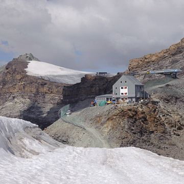
Zermatt – Theodul Hut via Kleine Matterhorn

Summary: Hiked up from Zermatt (1600m) to Trockener Steg (2900m), via Furi (+1300m, 4 hours). Took cable car from Trockener Steg to Kleine Matterhorn (3900m). Hiked from Kleine Matterhorn down to Theodul Pass/Hut (-500m, 1 hour). Spent night at Theodul Hut (dormitory accomodations, half pension).

Continue reading

Tour de Monte Rosa – Introduction

Two years earlier, we had begun the Tour de Monte Rosa, but poor weather and fatigue left us having hiked only the first three stages (of a total nine). Therefore we decided on this trip to try and complete the remaining ones.

The TMR circumambulates Switzerland’s highest mountain, the Monte Rosa. It is equally split between northern Italy and the Valais district of Switzerland. While the trail is often steep, frequently rough and occasionally exposed, no special equipment is required beyond perhaps for a small stretch of glacier between Zermatt and the Theodul Pass. Unlike long treks in the Sierras in California, the TMR passes through a number of small towns and villages. One therefore does not need to carry tent, sleeping bag, or a multiple-day supply of food.

The TMR is typically hiked as a 9 day trek. Both of our stints on the trail have been in mid-September, although in retrospect, late August might be a better time, so far as weather (rain and snow) is concerned. On the other hand, the TMR is a popular route, and as we found, going later had the advantage of having the trail largely to ourselves.

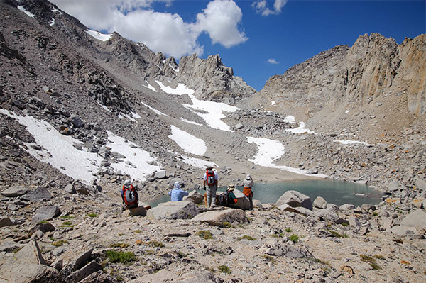
University Peak PCS trip

University Peak

On the first weekend of August, my dad and I joined a Sierra Club trip from Onion Valley to climb University Peak.

Summary

University Peak PCS Trip Saturday 1 August 2009
Route: Onion Valley trailhead via Kearsarge Pass trail and North Face (class 3), ~ 8 miles, 4500 ft.
Participants: 7

Continue reading

Amelia Earhart Peak and Mt. Dana PCS trip

Amelia Earhart Peak

In the middle of July, I went with some PCS folks for two days in upper Yosemite, to dayhike Amelia Earhart Peak and Mt. Dana.

Summary

Amelia Earhart Peak and Mt. Dana: July 11-July 12, 2009
Day 1: Amelia Earhart Peak from Tuolomne Meadows.  20 miles (16 on trail), ~3400 ft.
Day 2: Mt. Dana from Tioga Pass.  6 miles (use trail), ~3200 ft. 
Participants: 8

Continue reading

Yosemite Valley Hiking Trip

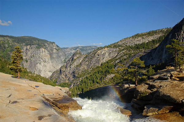
Nevada Falls

My dad and I did a weekend trip to Yosemite Valley to see the area before the end of spring and hike up Half Dome (our second time).

Summary

Yosemite Valley Hiking Trip: 5 June-7 June 2009
Day 1: Four Mile Trail, from Yosemite Valley to Glacier Point and back. 8.8 miles.
Day 2: Half Dome, from Yosemite Valley, via the JMT. ~18 miles.
Participants: 2

Continue reading

Lost Coast Backpacking trip

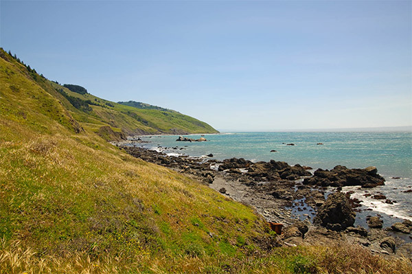
Lost Coast

Last weekend, me and my father joined a Sierra Club backpacking trip on the Lost Coast (between Mendocino and Eureka). It proved a neat 3-day trek along an isolated and gorgeous stretch of coastline.

Summary

Lost Coast PCS Backpacking Trip: 14 May-18 May 2009
Route: Lost Coast Trail, from Mattole River Trailhead (Lighthouse Rd., near Petrolia) to Black Sands Beach (near Shelter Cove). 24.6 miles over 3 days.
Participants: 6

Continue reading

Mt. Brewer PCS Trip

Mount Brewer


We were looking for an end-of-summer mountaineering trip in the high Sierra, and after examining and discarding several ideas, we were fortunate enough to find a Sierra Club trip to Mt. Brewer which we joined.  The trip was my first real peak-climbing trip with the Peak Climbing Section.

Summary

Mt. Brewer PCS Trip: August 15-August 17 2008

Day 0: Driving to Cedar Grove

Day 1: Backpacking in to East Lake, and setting up camp there.

Day 2: Ascending Mt. Brewer (elev. 13576 ft.) via the class 2-3 route along the southeast slope.

Day 3: Packing out and driving home.

Participants: 6

Continue reading

Mineral King Day 3: The return.

DSC 0382

We didn’t wake up quite as early as planned, so by the time we had gotten the tent more or less emptied and ready to pack up, the sun was peeking over the other side of the lake. As we ate breakfast, our friendly deer (or perhaps his cousin?) wandered by again, still largely oblivious to our presence. After a few granola bars, we were ready to attempt the return. It was just about 8AM

The trail going up from the other side of Spring Lake wasn’t too hard to find, but staying on it required continual care. After the initial ascent over the rock hill directly above the lake, we emerged in the morning sunlight, although we had some occasional shade for a while longer. The marmots were plentiful in the meadow, where we temporarily lost the trail. I counted 3.

Climbing across the meadow was actually pretty relaxing, and not too steep. Reaching the other end around 9AM, the trail began steep switchbacks up the talus slopes, and we once again lost it, this time recovering it only just below the main snowfield.

Climbing the snowfield was a challenge, but it felt far less difficult than descending had been. The 2 ski poles I had helped a lot though. As for the small class 3 section we’d had coming down right above this spot, we found an alternate rock to climb up, with no exposure, or need to drop the packs. Shortly after 9:30AM, we reached Glacier Pass.

As this was the morning, the views were considerably different from when we crossed two days before. We could definitely see bits of the trail on the other side of the valley, going up toward Black Rock Pass. Above that ridge, the top parts of the Kaweahs were also visible. We took a few pictures, had a snack, and determined what to do.

In a bid to make the return more interesting, and stay on a better trail, we elected to try and join the Sawtooth Pass trail, and descend via Monarch Lake. Around 10, we began traversing the white sand slopes on a reasonably well-marked path.

The problem with this descent was not that there were no paths, but that there were several. Finally, one promising pseudo-trail disappeared altogether, and we spent nearly half an hour scrambling down rocks and gullies to regain the main trail. Meanwhile, we passed a dizzying array of wildflowers, surprising given the sandy dry environment.

Once back on the trail, the remaining descent toward Monarch Lake was pretty straightforward. The lake, at 10,200 ft, shimmered a deep green. We weren’t alone at the lake either: good quantities of fish could be seen darting about. Sadly, mosquitoes were also present.

From Monarch Lake, we had a good definite trail. It was straight, a shallow grade, had no switchbacks, and had obviously required a lot of work. It traversed past a long slide areas of loose reddish rock, to return us, for the first time in quite a while, into a respectable coniferous forest.

In the forest, the trail changed character again, becoming all switchbacks. We saw our first hikers of the day, a pair who’d been going 6 days on a circuit to the eastern Sierras and back. One guy was wearing sneakers. Wow. Soon more hikers (mostly going up) followed. Ground squirrels and small birds were abundant, and we saw yet more marmots in several spots. The shade was very pleasant, as the day had become quite warm.

Emerging from the forest finally (I’d been counting altitude) at the crossing of Monarch creek, we stopped for lunch around 1:30PM. My blisters were doing okay, but I was pretty tired, so the half hour spent sitting under the trees by the stream was certainly welcomed.

Once finished, we resumed the descent. We were now on the dusty slopes below Timber Gap and Empire Mountain, and the heat was oppressive. Somehow, the last 700 ft. of descent felt like forever, even though we could see the parking lot becoming visibly nearer. At 2:30PM, we staggered into the Sawtooth Pass parking lot, hot and tired. We were followed by an equally tired group of hikers, one of whom was still nice enough to take a photograph of us at the trailhead. End of hike.

It took a good hour to change into clean clothes, retrieve our food from the bear locker and get ourselves and the car cool enough to think about leaving. We stopped at the ranger station on the way out for postcards, and the campground for bathroom and water. As the car was making disturbing screeching noises (as it had coming up), I let my dad drive.

The drive out from Mineral King was noteworthy mainly because it become steadily hotter, and because, as we were descending, we went somewhat faster. When we finally reached highway 198, around 5PM, I was feeling quite carsick. We had some nice views too, but the haze over the Central Valley tended to limit visibility in the direction we were going.

In Three Rivers, we stopped to pick up something cold to drink. The temperature was in the 90s, so it was more than just a question of comfort. Martinelli’s has rarely tasted so good.

From Three Rivers, I drove, continuing on 198 west, past Visalia, through Hanford, and continuing in a long and incredibly straight fashion towards I-5. We reached it around 6:30PM, with the sun offering a blinding glare in the west. From I-5, it was a long, but not quite so straight drive north. The trucks were numerous, and so I spent a lot of time in the passing lane, or attempting to avoid slipping into the newly paved margin. Around 7:30PM, I managed to get off at the wrong exit, getting the road right, and the direction wrong. Chalk it up to a long day.

On 152 west, the sun ceased to be a major issue, setting below the nearby hills. Traffic was considerable, but brisk, and we made good time to Gilroy. We arrived there around 9PM, with the sun having definitively set, and me tired enough to be happy to give over the wheel. The final stretch, up 101, then up 280, and finally home via 92, we listened to the trials and tribulations of Rumpole, the defense lawyer, in a libel action. A pleasant story, but the cassettes were hard to dig out of the overcrowded back-seat pouches.

We arrived back in HMB around 10:30PM. It was the usual 65 degree weather, which seemed downright cold after having baked most of the day on the trail and in the car. Once home, there was nothing for it but to have a quick dinner, and start unloading all the accreditions of the trip from the car. Went to bed with plenty more of that left to do tomorrow.
Mineral King Day 2: To the Great Western Divide

DSC 0243

The sun took its time rising. When we got up, around 7AM, it was just beginning to light up the far side of the lake. We had a light breakfast, pumped some water for the day, and set about arranging the day pack for the day. In the process, a deer, perhaps the same one we’d seen the night before, leisurely wandered by our camp, nibbling on bushes and things.

Our intended destination (after adjustments) was Black Rock Pass, the same pass we’d seen the day before from atop Glacier Pass. To get to the trail though, we would have to go cross country for a bit.

As usual, this proved easier said than done. Talus fields that looked easily passable from a distance proved something of a pain to navigate. We finally gave up trying to do a traverse along the side of the valley, and wound up following alongside the stream. This was not only much easier, but we passed through some amazingly lush meadows, and not a few wildflower patches. We left the tent around 8:30AM. It took us until a bit before 10 to reach the actual trail. It wasn’t as easy to find as we’d expected, but our strategy of aiming for the tree patch, through which we knew the trail passed, worked quite well.

The boots again were causing blisters, but there wasn’t a lot that could be done about this. The trail was well-marked, but narrow, and made wide sweeping switchbacks up the rocky slopes. In a few spots, small avalanches had eaten holes into the side of the trail. From the camp to where we picked up the trail, we’d descended several hundred feet, and ascended about a hundred. From here, it become a steady ascent. There was a cool breeze coming off the upper part of the mountain, so the sun, despite the lack of shade, wasn’t too bad.

Going up, the vegetation became continuously sparser. The trail also became steeper above 11,000 ft. and the switchbacks shortened. We saw nobody on the trail above us.

We finally crested Black Rock Pass (elev. 11,800 or so) just before 11AM. The views from the top were truly grand. The Kaweahs, in their different red, black and grey rock, were quite imposing, and didn’t seem at all near. Between us and them were a small constellation of lakes, and the deep walls of Big Arroyo canyon. More towards the East we could see the outlines of Kern Canyon, and the eastern Sierra, including what was probably Mt. Langley. More to the south on the other side of the divide we could clearly see Sawtooth Peak, and 3 lakes: Columbine, Crystal and Spring. Below us, on the Kaweah side, a number of hikers could be seen slowly ascending toward the pass.

This was the Great Western Divide (admittedly a bit of a misnomer, since the major divide is actually between the eastern Sierras and the central part we were looking at).

Sitting in a small notch above the pass, we rested our feet, nibbled on snacks, and finally got up again to start using the cameras. I found a marmot perched on a very interesting viewpoint. The ridge itself was actually reasonably flat, so you could go along it a good ways. When all 3 cameras had been duly exercise, we scrambled back down to the trail and asked some passing hikers to take our picture. They were from New York. Small world.

The descent was much easier on the feet than the ascent. Still, going down 1,800ft. takes time. A few large clouds had begun to move across the sky, making the lighting change dramatically from one moment to the next. When we finally reached the point where we’d joined the trail, we decided to try a different approach to return to our camp: cross the creek and aim for what looked like a trail on the other side.

This we did, but the other trail proved something of a mirage. So we were reduced to scrambling again, clambering over rocky ledges, attempting to cross through stands of bushes, and so on. It was tiring, and I was none too pleased with our constantly changing course. When we finally did crest a small hill by the head of Spring Lake, I was very grateful. It had taken us almost an hour just on the cross-country section.

In need of a rest, we had sat in some (by this point scarce) shade, and ate the remainder of lunch. After some discussion, it was agreed that we would return via Glacier Pass, and not via Timber Gap. The deciding factor for me was the likelihood of mosquitoes at camps farther down, a problem Spring Lake basically didn’t have.

Since we weren’t going anywhere in particular, I suggested walking around the lake. This proved a fun, if somewhat longer than expected diversion. It may have been a small lake, but it was plumb with inlets and curvy shores. We passed through small meadows, below cliffs, through forests, and even across a snow field, not to mention fording innumerable small streams. By the time we had seen the lake from all sides (and discovered that it contained fish) it was almost 6PM.

So we could in good conscience cook dinner (a turkey-based freeze-dried dish). The butane stove once again proved sufficient for the task, only this time we added less water, so we got a stew, rather than a soup, out of the operation. We also had to pump a lot of water so as to have everything ready for an early start the next day. After nibbling and packing for a bit, we went into the tent. No problem falling asleep not long after 8PM. Guess exercise really is the best relaxant.

Mineral King Day 1: To Spring Lake

DSC 0154


Cold Springs campground, I discovered around 7AM, also meant cold mornings. Whatever. Rise and shine. So we scrambled out of our sleeping bags, and, as there was no tent, decamped in less than no time. The hard part was in fact stuffing our backpacks with all the necessaries for the next 3-4 days, a task not simplified by the subfreezing temperature of my hands. Sunup does not always a sunny place make.

It took a good hour to put together the packs, which, despite enormous care, were rapidly approaching the 30 pound mark. Though mine was the lighter of the two (tent instead of food and stove), I was already envying day-hikers. Around a quarter past 8, we finally drove out of Cold Springs, in search of the ranger station. It only required driving 2-miles in the wrong direction to ascertain that we had not missed the station the evening before: it was simply on the other part of the road.

The rangers were helpful, but a bit vague. From what we gleaned, the trail from Monarch Lake to Sawtooth Pass was mostly sand, and not particularly well-marked. Glacier Pass would not be difficult to reach, but it still retained some snow on the north-facing slope. A few pleasantries about the efficacy of real trails rather than ‘use’ trails later, we were on our way.

At the Sawtooth Pass trailhead, we emptied the car of edibles, roped up with our packs (the process can often leave one feeling like a tortoise that has become stuck on his back), and with a clear blue sky and blazing sun, were on our way at half past 9.

The stretch of trail to the Timber Gap junction was steep, but bearable. Being fresh helped, and my boots hadn’t yet raised the enormous blisters they were capable of. From there to the Monarch Creek crossing went swiftly too. We had good but slightly hazy views of Mineral King and Farewell Canyon as we climbed. The whole area was very dry and not a little dusty.

We crossed Monarch Creek shortly after 10AM, and the trail swiftly entered the trees. We met a somewhat startled deer a few switchbacks up, before running into our first hikers. When we mentioned Glacier Pass to them, we were strongly urged to descend back to the creek crossing, and search for a use-trail on the other side. This would avoid over 1000 feet of elevation gain in the sand below the pass.

Thinking nothing of it, and seeing the trail they mentioned clearly on the opposite hillside, we attempted to do just that. It was only after we had reached the bottom, and could find no trace of the trail we saw, that we realized route-finding was going to require a lot more care.

The next hour was an exhausting off-trail scramble up the canyon, as we attempted to reach the area where we thought the trail should have been. It was a tortuously slow process, and we only discovered the trail we’d been searching for by accident, long after we’d basically given up.

My boots were at this point causing major pain, so a rest was in order, as was a change of socks. The trail we had found proved easy to lose, and impossible to follow. Despite meeting three separate groups of hikers coming down (each with advice), we completely lost the trail at least two more times. From noon to 3PM we made our slow approach to Glacier Pass, below the southern spurs of Empire Mountain. The trail was all rocks and talus. The markings for it did not exist. My feet hurt. It was hot.

Still, at 3:15PM, we were on top of a pass, and indeed it was the pass that we had been aiming for. The trail down looked considerably more obvious, although the slope was extremely steep, and just as rocky as what we’d just climbed. The views, especially looking north at the Great Western Divide, were impressive.

At this point it was clear that we were not going to make it over yet another pass on the other side (we could see the trail, even at this distance) that day, so instead we aimed at the currently invisible Spring Lake, somewhere in the valley in front of us.

Climbing down was a bit worrisome at the start as well. First, there was scrambling over boulders on steep slopes. At one point, I was descending a rock backwards, with only minor footholds, with a 20 foot drop below me. Once the steep section ended, we were going down hard snow for almost 100 yards. There were a number of anxious moments, but neither of us slid too far on the way down.

Soon though, our route became a substantial trail, and we left the talus for a green meadow with charming little ponds and many curious marmots. Then we came out of this bowl to another rocky section, this time with a clear view of the large lake by which we hoped to camp. Getting down to Spring Lake was quite steep, but when we did arrive, around 5PM, it was to a gorgeous blue lake, surrounded by meadows, a few small trees, and on one side, a gigantic snowfield with a cliff above it.

We picked our camp on a strip of land between the main lake and its smaller auxiliary. In due course, the tent was assembled, and we set about preparing dinner. The innovation of the trip was a tiny butane stove and a number of freeze-dried meals. Right about the time we were boiling the water for a ‘Turkey tetrazini’ supper, the sun sank below the ridge beyond the far side of the lake, giving us a colorful sunset, but leaving us in deep and deepening shade.

Dinner wound up being more of a soup than a dish, but having had no lunch, a larger (and soggier) meal wasn’t a problem. The sun had set around 7 on our camp, and by 8PM, as we cleaned up, the stars were coming out. Soon, we had not only stars, but the whole Milky Way galaxy in our view. The tent, without the rainfly, was basically see-through, so we could admire the sky from our sleeping bags. The air was so dry that when I accidentally rubbed my watch with my hand, I saw sparks.

Not long after 9, I dozed off. We had a brief spell of high winds during which the tent did fine (the wind passed right through it) but sleeping was hard on account of the noise. When I woke up the next morning around 6AM, with the sky already lightened (though the sun still hidden), it was actually too warm inside the sleeping bag!